Pricing Change
New pricing for orders of material from this site will come into place shortly. Charges for supply of digital images, digitisation on demand, prints and licensing will be altered.
Sands Of Forvie
Lithic Working Site (Prehistoric)
Site Name Sands Of Forvie
Classification Lithic Working Site (Prehistoric)
Canmore ID 87194
Site Number NK02NW 29
NGR NK 010 251
Datum OSGB36 - NGR
Permalink http://canmore.org.uk/site/87194
- Council Aberdeenshire
- Parish Slains
- Former Region Grampian
- Former District Gordon
- Former County Aberdeenshire
NK02NW 29 010 251.
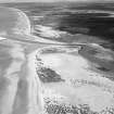
An area of 120m by 60m of an exposed land surface in the dunes near the mouth of the River Ythan was studied. Scatters of flint knapping debris were recorded and collected (including an anvil stone), while a date was implied by the discovery of a barbed-and-tanged arrowhead.
Sponsor: Marischal Museum Young Archaeologists
E Curtis and N Curtis 1994.
NK 01 25 A survey of flint-bearing raised beach surfaces adjacent to those examined by the Marischal Museum Young Archaeologists (Curtis and Curtis 1994) was undertaken. This fieldwork, coupled with the analysis of the 5787 lithics collected by the Marischal Museum, suggests the existence of a number of fairly discrete foci of Mesolithic artefacts and a broader distribution of undiagnostic bipolar and crude flint debris, suggestive of very expedient knapping strategies. A collection of c 4000 artefacts was made from an 8 x 20m transect over the sea cliff through one focused scatter located in a low scoop in this surface. The Mesolithic artefacts are much more numerous on the raised beach itself than beneath it. The artefacts include numerous blades, cores and a range of geometric microliths, especially rod-like forms.
Sponsors: Historic Scotland, Abercromby Fund, Society of Antiquaries of Scotland (NE section).
G Warren 1999.
Project (May 2022 - May 2023)
A Community Coastal Zone Assessment Survey (CCZAS) of the Aberdeenshire coast from Cullen at the Moray-Aberdeenshire council boundary to Milton Ness at the Aberdeenshire-Angus council boundary was undertaken. The survey area also included a stretch of coastline from Blackdog to Bridge of Don which falls within the City of Aberdeen council boundary.
The aim of the survey was to characterise and assess the condition and vulnerability of the coastal archaeological resource along stretches of coastline identified as being at moderate to high risk of erosion by 2030. Most of the accessible coastline falling into this category was walked by SCAPE officers and volunteers over several separate surveys between May 2022 and May 2023.
Information from S Boyd and J Hambly - Scottish Coastal Archaeology and the Problem of Erosion (SCAPE)
Field Visit (October 2022)
NK 01000 25100 Small area of exposed raised beach full of struck flint (Mesolithic). The remainder of the blowout covered in a thick layer of sand. There are further records of past flint scatter finds within the sand blowout, approximately 100m north of this site.
Information from S Boyd and J Hambly - Scottish Coastal Archaeology and the Problem of Erosion (SCAPE)


