
Pricing Change
New pricing for orders of material from this site will come into place shortly. Charges for supply of digital images, digitisation on demand, prints and licensing will be altered.
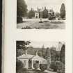
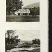
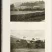
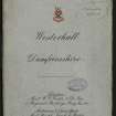
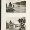
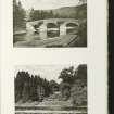
Westerkirk Mains


Farmhouse (Period Unassigned), Farmstead (Period Unassigned)
Site Name Westerkirk Mains
Classification Farmhouse (Period Unassigned), Farmstead (Period Unassigned)
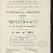
Alternative Name(s) Westerhall Estate
Canmore ID 86816
Site Number NY29SE 87
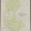
NGR NY 2942 9162
Datum OSGB36 - NGR
Permalink http://canmore.org.uk/site/86816


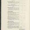

- Council Dumfries And Galloway
- Parish Westerkirk
- Former Region Dumfries And Galloway
- Former District Annandale And Eskdale
- Former County Dumfries-shire
NY29SE 87 2942 9162
For tower-house at Westerkirk (NY c. 294 916), see NY29SE 86.

