Scheduled Maintenance
Please be advised that this website will undergo scheduled maintenance on the following dates: •
Tuesday 3rd December 11:00-15:00
During these times, some services may be temporarily unavailable. We apologise for any inconvenience this may cause.
Forse House
Field System (Period Unassigned), Hut Circle(S) (Prehistoric)
Site Name Forse House
Classification Field System (Period Unassigned), Hut Circle(S) (Prehistoric)
Canmore ID 8659
Site Number ND23SW 6
NGR ND 205 348
NGR Description Centred ND 205 348
Datum OSGB36 - NGR
Permalink http://canmore.org.uk/site/8659
- Council Highland
- Parish Latheron
- Former Region Highland
- Former District Caithness
- Former County Caithness
ND23SW 6 centred 205 358
Extends onto map sheet ND23NW.
(ND 205 358) Cairns (NR)
OS 6" map, (1959)
A group of hut circles about 1/2 mile SW of Forse House. One, some 50 yds W of the wall of a decayed plantation, has an ill-defined, grass-covered wall about 6 1/2 ft thick and 35 ft in daimeter over all. The entrance has been in the E, where one portal stone just protrudes from the turf. Three hut circles lie close together some 200 yds to the NW. The central, and highest, one has a stony bank, 26ft in internal diameter with an entrance of indeterminate width in the SE. In front of this circle is a circular enclosure, marked by a line of huge slabs and boulders, some 40 yds in diameter. The S circle of this group of three is extremely dilapidated. In the centre is a circular hollow, 8ft in diameter and 2 1/2ft deep, apparentely 'built up' (revetted ?) at the back. The E hut circle is almost contiguous with the central one. It has an internal diameter of 19ft, but its wall thickness is indeterminate. The entrancce, in the SE, is 2 3/4ft wide. Another ruined hut circle lies about 100 yds W of the last. It has an internal diameter of 24ft, a wall thickness of 6ft, and an entrance in the SE. Some 30ft NE, and connected by a line of large boulders, is another small circle formed in the arc of a large circular enclosure defined by boulders and slabs set upright. In connection with these circles are various curving lines of great slabs and boulders set on end forming the boundaries of enclosures.
RCAHMS 1911.
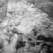
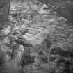
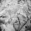
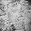
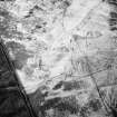
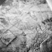
Centred ND 205 348 at between 300 and 400ft OD, is a settlement of fifteen hut circles and an associated field system.
Hut circles A - E are described by the RCAHMS. The small 'circle' 30ft NE of 'E' is a curved part of field wall, not a hut circle. The remaining hut circles are of similar construction to those described, varying in size from 8.0 to 12.0m in diameter with entrances, where apparent, in the SE.
Besides the hut circles there are two small oval enclosures formed by low, stony banks. One, at ND 2022 3484, measures approximately 5.0 by 6.5m, while the other, at ND 2023 3470, measures approximately 8.0 by 6.0m, both possibly being hut sites.
The field system, defined by substantial field walls, most prominent in its centre, lynchets, and a few stone clearance heaps, is rather complex, being a mixture of different periods of cultivation.
Surveyed at 1:2500.
Visited by OS (R L) 13 March 1968.
Scheduled (in part) with ND23NW 11, ND23NW 12, ND23NW 13, ND23NW 37 and ND23SW 9, ND23SW 21, ND23SW 22, ND23SW 24, ND23SW 25 as 'Forse House, settlement, field system, burnt mounds and cairns... an extensive area of remains, including those of deserted farmsteads ... together with associated cultivation remains of various dates, small cairns and burnt mounds.'
Information from Historic Scotland, scheduling document dated 30 January 2003.
Field Visit (28 September 2018)
A desktop and walkover survey was conducted in September 2018 for an area of proposed woodland of 38 hectares, the site enclosing the site of a burnt mound (NRHE ND23SW 23) and two enclosures (NRHE ND23SW 6). Work noted a field system of rough boulders likely to be associated with oval structure at ND 20212/34846 (site H of ND23SW 6).
Information from Stuart Farrell.


