
Pricing Change
New pricing for orders of material from this site will come into place shortly. Charges for supply of digital images, digitisation on demand, prints and licensing will be altered.
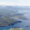
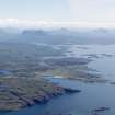
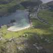
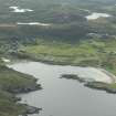
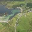
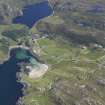
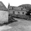
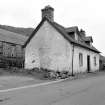
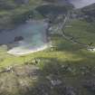
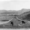
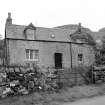
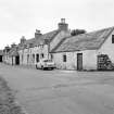
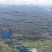
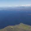
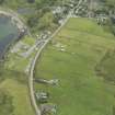
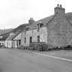
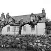
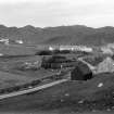
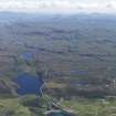
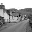
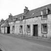
Scourie


Township (Period Unassigned)
Site Name Scourie
Classification Township (Period Unassigned)
Canmore ID 86421
Site Number NC14SE 22
NGR NC 156 445
NGR Description centred in NC 156 445
Datum OSGB36 - NGR
Permalink http://canmore.org.uk/site/86421


- Council Highland
- Parish Eddrachillis
- Former Region Highland
- Former District Sutherland
- Former County Sutherland
NC14SE 22.00 (centred on 156 445)
A crofting township comprising forty-one roofed, four partially roofed and three unroofed buildings is depicted on the 1st edition of the OS 6-inch map (Sutherland 1878, sheet xxxix). Sixty-six roofed and one unroofed building are shown on the current edition of the OS 1:10,000 map (1992).
22.01 1572 4481 Watermill
Information from RCAHMS (SAH) 28 August 1995

