
Warehouse


Boundary Stone (Period Unassigned)
Site Name Warehouse
Classification Boundary Stone (Period Unassigned)
Canmore ID 86246
Site Number ND34SW 152
NGR ND 30462 42147
Datum OSGB36 - NGR
Permalink http://canmore.org.uk/site/86246


- Council Highland
- Parish Wick
- Former Region Highland
- Former District Caithness
- Former County Caithness
ND34SW 152 30462 42147
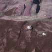
This stone stands on the parish boundary between Latheron to the SW and Wick to the NE, but local tradition suggests that it was erected in the 19th century by Thrumster estate to mark the highest point on the SW part of its march. The stone is a slab of sandstone measuring 0.7m from NW to SE by 80mm transversely and 1.7m in height. At ground-level the stone is rather thicker, measuring 0.2m in thickness, and possibly indicating that a large part of its SW face has broken away. Immediately SE of the stone there is a larger slab of sandstone from which the erect stone may have been quarried.
(YARROWS04 030)
Visited by RCAHMS (JRS) 13 May 2004

