
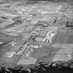
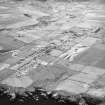
Lybster, Harbour Road, Seaview House


House (Period Unassigned)
Site Name Lybster, Harbour Road, Seaview House
Classification House (Period Unassigned)
Canmore ID 8620
Site Number ND23NW 20
NGR ND 2469 3526
Datum OSGB36 - NGR
Permalink http://canmore.org.uk/site/8620


- Council Highland
- Parish Latheron
- Former Region Highland
- Former District Caithness
- Former County Caithness
ND23NW 20 2469 3526
Early 19th century house, somewhat dilapidated; of local dressed stone; it was originally the house of an important fish curer
HBD No. 5.

