
Clythshore


Settlement (Period Unassigned)
Site Name Clythshore
Classification Settlement (Period Unassigned)
Alternative Name(s) Lat 229a
Canmore ID 8594
Site Number ND23NE 26
NGR ND 279 358
NGR Description ND c. 279 358
Datum OSGB36 - NGR
Permalink http://canmore.org.uk/site/8594


- Council Highland
- Parish Latheron
- Former Region Highland
- Former District Caithness
- Former County Caithness
ND23NE 26 c. 279 358
Clythshore. Four fishers houses and a cooperage.
OS 6" map, Caithness, 1st ed., (1871); Name Book 1871.
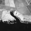
ND 2787 3585. A partially upstanding, rectangular structure, 26m NE-SW by 7m, whose walls average 0.8 in thickness and stand to a maximum height of 4.5m although they are mostly represented by rubble spread. In the SW wall there are traces of a blocked entrance or window.
C E Batey 1982.
Project (1980 - 1982)

