Following the launch of trove.scot in February 2025 we are now planning the retiral of some of our webservices. Canmore will be switched off on 24th June 2025. Information about the closure can be found on the HES website: Retiral of HES web services | Historic Environment Scotland
Castlehill
Broch (Iron Age)(Possible), Inhumation (Viking)
Site Name Castlehill
Classification Broch (Iron Age)(Possible), Inhumation (Viking)
Canmore ID 8383
Site Number ND16NE 11
NGR ND 1936 6876
Datum OSGB36 - NGR
Permalink http://canmore.org.uk/site/8383
- Council Highland
- Parish Olrig
- Former Region Highland
- Former District Caithness
- Former County Caithness
ND16NE 11 1936 6876
(ND 1936 6876) Broch (NR) (remains of)
Viking Burial found AD 1786 (NAT)
OS 6" map, (1970)
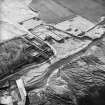
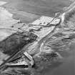
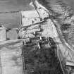
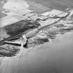
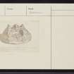
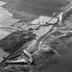
This grassy mound, which contains the ruins of a broch, has been robbed to some extent from the S. The remaining portion is some 54ft in diameter and 7ft high.
A skeleton, accompanied by a pair of 10th century (Glasgow Art Gallery and Museum 1951) Norse tortoise brooches, a jet armlet 3ins in diameter, and a bone pin 8cm long, was found in September 1786 on top of this mound, buried under a flat stone with very little earth above it. One of the brooches is in the National Museum of Copenhagen, while the other relics are in the National Museum of Antiquities of Scotland (NMAS, Accession nos: IL 222, FN 2 & FN 3 respectively).
Archaeol Scot 1831; J Anderson 1874; J Anderson 1878; NMAS 1892; RCAHMS 1911; S Grieg 1940; Glasgow Art Gallery and Museum 1951.
This artificial, grass-covered, conical mound, which measures 19.0m E-W by 13.0m transversely and 2.7m high, contains many protruding stone slabs and has been mutilated on the N side by the construction of a wall and track and by ploughing along the S side. It may have been a broch but its present condition makes classification difficult.
Resurveyed at 1:2500.
Visited by OS (N K B), 16 February 1965.
The mound, probably the remains of a broch, is as described by the previous field investigator.
Visited by OS (J B), 2 November 1981.
Publication Account (2007)
ND16 1 CASTLEHILL ND/1936 6876
Possible broch in Olrig, Caithness, consisting of a grassy mound with many protruding stone slabs; it has been robbed on the south. A Norse burial was found on top of the mound in 1786, with two 10th century brooches, a jet armlet and a bone pin (7.6cm long) [2, 3 and 5].
Sources: 1. NMRS site no. ND 16 NE 11: 2. Anderson 1874, 549-50: 3. Anderson 1878, 329-30: 4. RCAHMS 1911b, 87, no. 320: 5. Greig 1940, 2, 23-4: 6. Mercer 1981, 156, no. 530: 7. Anderson 1890, 184.
E W MacKie 2007


