 |
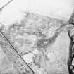
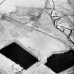
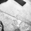
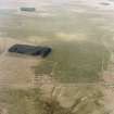
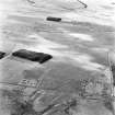
On-line Digital Images |
SC 1749023 |
RCAHMS Aerial Photography |
Oblique aerial view. |
1992 |
Item Level |
|
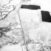 |
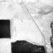
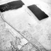
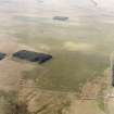
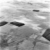
On-line Digital Images |
SC 1749024 |
RCAHMS Aerial Photography |
Oblique aerial view. |
1992 |
Item Level |
|
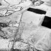 |
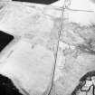
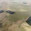
On-line Digital Images |
SC 1749025 |
RCAHMS Aerial Photography |
Oblique aerial view. |
1992 |
Item Level |
|
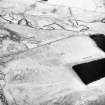 |
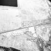
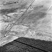
On-line Digital Images |
SC 1749026 |
RCAHMS Aerial Photography |
Oblique aerial view. |
1992 |
Item Level |
|
 |
On-line Digital Images |
SC 1749027 |
RCAHMS Aerial Photography |
Oblique aerial view. |
1992 |
Item Level |
|
 |
On-line Digital Images |
SC 1749028 |
RCAHMS Aerial Photography |
Oblique aerial view. |
1992 |
Item Level |
|
 |
On-line Digital Images |
SC 1749029 |
RCAHMS Aerial Photography |
Oblique aerial view. |
1992 |
Item Level |
|
 |
On-line Digital Images |
SC 1749030 |
RCAHMS Aerial Photography |
Oblique aerial view. |
1992 |
Item Level |
|
 |
On-line Digital Images |
SC 1749031 |
RCAHMS Aerial Photography |
Oblique aerial view. |
1992 |
Item Level |
|
 |
On-line Digital Images |
SC 1749032 |
RCAHMS Aerial Photography |
Oblique aerial view. |
1992 |
Item Level |
|
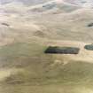 |
On-line Digital Images |
SC 1749072 |
RCAHMS Aerial Photography |
Pennymuir, oblique aerial view, taken from the WNW, centred on three Roman Temporary Camps, a linear earthwork and an area of rig. The course of 'Dere Street' is visible in the centre of the photograph. |
30/8/1995 |
Item Level |
|
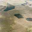 |
On-line Digital Images |
SC 1749073 |
RCAHMS Aerial Photography |
Pennymuir, oblique aerial view, taken from the SW, centred on Roman Temporary Camps, a linear earthwork and an area of rig. The course of 'Dere Street' is visible in the top right half of the photograph. |
30/8/1995 |
Item Level |
|
 |
On-line Digital Images |
SC 1749074 |
RCAHMS Aerial Photography |
Pennymuir, oblique aerial view, taken from the ENE, centred on three Roman Temporary Camps, a linear earthwork and an area of rig. The course of 'Dere Street' is visible in the bottom half of the photograph. |
30/8/1995 |
Item Level |
|
 |
On-line Digital Images |
SC 1749075 |
RCAHMS Aerial Photography |
Pennymuir, oblique aerial view, taken from the NE, centred on three Roman Temporary Camps, a linear earthwork and an area of rig. The course of 'Dere Street' is visible in the bottom half of the photograph. |
30/8/1995 |
Item Level |
|
 |
On-line Digital Images |
SC 1749076 |
RCAHMS Aerial Photography |
Pennymuir, oblique aerial view, taken from the NE, centred on Roman Temporary Camps, a linear earthwork and an area of rig. The course of 'Dere Street' is visible in the bottom half of the photograph. |
30/8/1995 |
Item Level |
|
 |
On-line Digital Images |
SC 1749081 |
RCAHMS Aerial Photography |
Pennymuir, oblique aerial view, taken from the NW, centred on three Roman Temporary Camps and an area of rig. The course of 'Dere Street' is shown in the left half of the photograph. |
30/8/1995 |
Item Level |
|
 |
On-line Digital Images |
SC 1749082 |
RCAHMS Aerial Photography |
Pennymuir, oblique aerial view, taken from the WSW, centred on three Roman Temporary Camps, a linear earthwork and an area of rig. The course of 'Dere Street' is shown in the centre of the photograph. |
30/8/1995 |
Item Level |
|
 |
On-line Digital Images |
SC 1749083 |
RCAHMS Aerial Photography |
Pennymuir, oblique aerial view, taken from the WSW, centred Roman Temporary Camps, a linear earthwork and an area of rig. The course of 'Dere Street' is shown in the centre of the photograph. |
30/8/1995 |
Item Level |
|
 |
On-line Digital Images |
SC 1749084 |
RCAHMS Aerial Photography |
Pennymuir, oblique aerial view, taken from the SW, centred on Roman Temporary Camps, a linear earthwork and an area of rig. The course of 'Dere Street' is shown in the centre of the photograph. |
30/8/1995 |
Item Level |
|
 |
On-line Digital Images |
SC 1749085 |
RCAHMS Aerial Photography |
Pennymuir, oblique aerial view, taken from the SW, centred on Roman Temporary Camps and a linear earthwork. The course of 'Dere Street' is visible in the centre of the photograph. |
30/8/1995 |
Item Level |
|
 |
On-line Digital Images |
SC 1749086 |
RCAHMS Aerial Photography |
Pennymuir, oblique aerial view, taken from the WNW, centred on three Roman Temporary Camps, a linear earthwork and an area of rig. The course of 'Dere Street' is visible in the bottom half of the photograph. |
30/8/1995 |
Item Level |
|
 |
On-line Digital Images |
SC 1749087 |
RCAHMS Aerial Photography |
Pennymuir, oblique aerial view, taken from the NE, centred on Roman Temporary Camps, a linear earthwork and an area of rig. The course of 'Dere Street' is visible in the bottom half of the photograph. |
30/8/1995 |
Item Level |
|
|
Digital Files (Non-image) |
TM 000541 |
Records of the Royal Commission on the Ancient and Historical Monuments of Scotland (RCAHMS), Edinbu |
Zip file containing all survey linework data recorded during the RCAHMS Afforestable Land Survey of Kale Water 1999 |
1999 |
Item Level |
|
|
All Other |
551 166/1/1 |
Records of the Ordnance Survey, Southampton, Hampshire, England |
Archaeological site card index ('495' cards) |
1947 |
Sub-Group Level |
|


