Pennymuir
Temporary Camp (Roman)
Site Name Pennymuir
Classification Temporary Camp (Roman)
Alternative Name(s) Towford; Pennymuir, Camp A; Dere Street
Canmore ID 83741
Site Number NT71SE 5.01
NGR NT 754 139
Datum OSGB36 - NGR
Permalink http://canmore.org.uk/site/83741
- Council Scottish Borders, The
- Parish Hownam
- Former Region Borders
- Former District Roxburgh
- Former County Roxburghshire
NT71SE 5.01 754 139
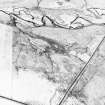
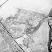
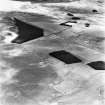
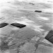
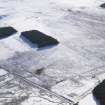
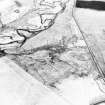
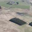
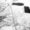
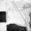
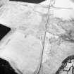
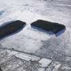
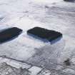
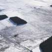
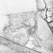
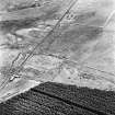
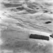
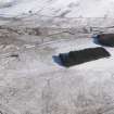
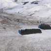
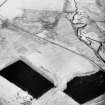
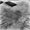
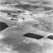
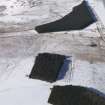
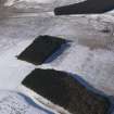
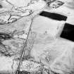
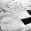
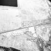
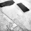
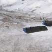
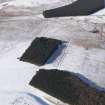
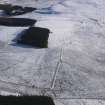
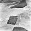
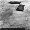
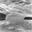
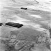
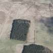
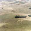
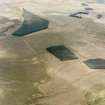
Camp A: (RCAHMS 1956, plans, figs), the largest of the group, lies close to the W side of Dere Street on a platform of moderately even ground which slopes gently to N and E. Its S end lies on the edge of a small, dry gully. Approximately rectangular in shape, it encloses 42 acres, an area sufficient for the accommodation of two legions. The E and W sides are each 1705' long, the N side 1080' and the S side 1155'. The southern half of the E side, and practically the whole of the S side, have been obliterated by rig-cultivation, but the missing sections are, for the most part, revealed by vegetation marks on air photographs. Elsewhere the defences have not been ploughed and are in a fine state of preservation. The rampart, which is formed of upcast material from the ditch, measures some 15' in thickness at the base and up to 4' high, while the ditch is 15' wide and occasionally attains a depth of 4'. There is little or no berm. Five gates are now visible and a sixth may be assumed to have existed in the E side, matching the southernmost of the two W gates. The gates vary from 57' to 68' in width and are all protected by traverses: their relationship suggests that the camp faced northwards. The earthworks shown on the OS map both inside and outside the SW corner of the camp are not of Roman date: two of them are sheep-folds while the third is a land boundary.
RCAHMS 1956, visited 1949
Centred NT 755 139. The remains of Camps 'A' and 'B' have been fully described above. As stated, the earthworks within and without the SW angle are later works: two sheepfolds and an old turf (? field) bank.
Visited by OS (JLD) 11 August 1960
Generally as described by previous authorities.
Visited by OS (RD) 30 May 1968.
No change to the previous information.
Visited by OS (BS) 8 September 1976.
Publication Account (1985)
At Tow Ford on the Kale Water the main Roman trunk road (and the Dere Street of medieval times) comes down from the Cheviots on its way north. Passing between the best preserved group of temporary Roman camps in Scotland, it continues upwards again past prehistoric cairns and a stone circle, and between drovers' dykes to Whitton Edge (a fine broad ridge
walk); thence to Shotheids, Rennieston and the now vanished fort at Cappuck. It crosses the Teviot, in the vicinity ofMonteviot House, and thus to Newstead, Lauderdale, Soutra and the Forth.
There are four camps bleakly situated at Pennymuir. One right down by the Kale Water (NT 757138) is badly eroded by both the river and by subsequent cultivation. A second camp (NT 756144) is bisected by the Pennymuir-Hownam road-though the western third survives sufficiently to show a trapezoidal rather than rectangular plan. The lie of the ground would not have required this; rather may it have been due to a misuse of sighting lines or to the availability of only short measuring rods!
The most visible camp, and the largest, lies to the west of the Roman road (NT 754138)-here the line of the little road from Pennyrnuir to Tow Ford. Most of the south side and the south part of the east side have been obliterated by rig-cultivation, but sufficient remains to show that this corner of the camp contained a separate smaller camp. Since the ditch of the latter cuts across the rampart of the larger camp it must be secondary, but like the larger version it seems to have had six gates, each of them protected by a 'traverse'-a blocking banier set outside the entrance, allowing access only round its ends. Both camps were enclosed by a rampart formed from the upcast from a single, outer ditch.
It may be assumed that these temporary camps were training bases, providing tented accommodation for troops on exercise, most commonly perhaps on Wo den Law (no. 83). The largest camp spreads over some 17 ha and could certainly have accommodated two legions-GOOD men or more. It may, however, simply have been a temporary marching camp.
Information from 'Exploring Scotland's Heritage: Lothian and Borders', (1985).
Publication Account (17 December 2011)
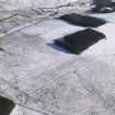
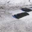
The three, possibly four, camps at Pennymuir lie on rough moorland in the Cheviot Hill beside Dere Street, close to its descent from Woden Law and on the north bank of the Kale Water. All four are recorded as earthworks in rough moorland, with camps I and II amongst the best preserved in Scotland. These two were first recorded in 1774 by William Roy (1793: Pl. XXII), with camp II occupying the south-east corner of camp I. The larger camp measures 520m from NNW to SSE by 343m transversely and enclosed almost 18ha (44 acres). Entrance gaps protected by tituli are visible on all four sides, with two on the WSW side, and the camp probably had six gates in total. The upstanding rampart of the camp measures up to 4.6m wide and 1.2m high, with the ditch some 4.6m wide and up to 1.2m deep in places.
Camp II, which utilises part of the ESE and SSE sides of camp I, measures 299m from NNW to SSE by 129m, enclosing 3.9ha (9.7 acres). Its defences are of similar dimensions to camp I. Entrance gaps protected by tituli are visible on the WSW (two) and NNW sides, and the camp also probably had six in total. Detailed field survey by RCAHMS noted that the more northerly of the two gates in the south-west side had been narrowed, which they argued might represent a reoccupation of the camp in Roman times (1956: 376).
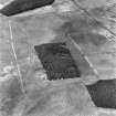
Camp III is situated just to the north-east of camps I and II , on the east side of Dere Street and, although recorded as an earthwork, has been partially obliterated by drainage and a plantation. It was recorded during scrutiny of RAF air photographs by RCAHMS in 1947 (Taylor 1948: 83; RCAHMS 1956: 375–7). It is a parallelogram in form, measuring 279 from north-west to south-east by 186m, and enclosed 5.1ha (almost 13 acres). The rampart survives in places as a low mound, some 2m wide and 0.2m high. Drainage ditches observed in 1949 showed that the ditch was about 1m wide and up to 0.5m deep, while the rampart was 2.1m wide and 0.3m high (RCAHMS 1956: 375–7). Entrance gaps with tituli are visible in the northwest and south-west sides. A section was cut through the titulus on the south-west side in 1949 (by Sir W. Aitchison – RCAHMS 1956: 377) but no further information is available.
A probable fourth camp at Pennymuir was located during the study of the RAF air photographs (RCA HMS 1956: 375–7) lying on the east side of Dere Street across from camps I and II . Only part of the camp has been recorded, measuring 192m from NNW to SSE by at least 120m, suggesting that at least 2.3ha (5.6 acres) was enclosed. The rampart is visible as a low spread mound, recorded in 1949 as measuring 4m wide and 0.3m high, with a ditch 3m wide and 0.3m deep outside (RCAHMS 1956, 377). Cultivation remains and drainage ditches cut through the camp, and RCAHMS used this evidence and the dimensions of its perimeter defences to argue for a Roman date (1956: 377).
R H Jones.
Aerial Photography (2019)
NT 753 136 Pennymuir Temporary Camps, NT 765 123 Woden Law fort, NT 769 118 Dere Street Roman road and earlier cross-ridge earthworks.
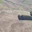
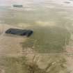
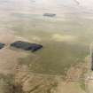
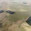
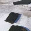
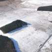
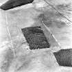
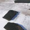
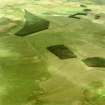
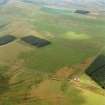
A preliminary photographic trial using a drone camera was carried out over the Roman camps which flank Dere Street (Canmore ID: 83741). Camps A, B and D responded well where the earthworks were unploughed, while an Infra-red filter revealed parts of the perimeter of Camp C where cultivation had removed all surface traces.
Woden Law fort (Canmore ID: 58068) was subjected to vertical photographic scan and 3D modelling; these picked out the ramparts very clearly, as well as some of the extensive cord-rig that covers the slopes immediately below the outermost ‘Roman’ earthworks on the east side.
The Roman road, Dere Street was photographed where it crosses a narrow neck of ground south-east of the fort between Whitehope Cleuch and Twisehope Cleuch; the scan revealed its embankment over five earlier cross-ridge dykes (Canmore ID: 58075, 58105) and tell-tale quarry pits where the road to the south is terraced into the hillside. Part of a nearby palisaded homestead (Canmore ID: 58109) was also included in the survey.
Archive: NRHE (intended); 3D modelling at https://sketchfab.com/3d-models/wodens-law-hill-fort-3b241068ffe0463dad356942d5801711;
Funder: Private individuals
Tony Hunt and John Dent
(Source: DES Vol 20)
Sbc Note
Visibility: This is an upstanding building.
Information from Scottish Borders Council.


