
Pricing Change
New pricing for orders of material from this site will come into place shortly. Charges for supply of digital images, digitisation on demand, prints and licensing will be altered.
Suttie


Enclosure (Period Unassigned), Palisaded Enclosure (Period Unassigned)(Possible), Pit(S) (Period Unassigned), Rig And Furrow (Medieval) - (Post Medieval), Ring Ditch(S) (Period Unassigned)
Site Name Suttie
Classification Enclosure (Period Unassigned), Palisaded Enclosure (Period Unassigned)(Possible), Pit(S) (Period Unassigned), Rig And Furrow (Medieval) - (Post Medieval), Ring Ditch(S) (Period Unassigned)
Alternative Name(s) Wester Fintray
Canmore ID 83672
Site Number NJ81NW 38
NGR NJ 81180 15810
NGR Description Centred NJ 81180 15810
Datum OSGB36 - NGR
Permalink http://canmore.org.uk/site/83672


- Council Aberdeenshire
- Parish Fintray
- Former Region Grampian
- Former District Gordon
- Former County Aberdeenshire
NJ81NW 38.00 Centred NJ 81182 15819
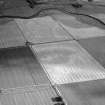
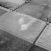
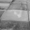
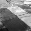
NJ81NW 38.01 NJ 8118 1581 Ring-ditch; Enclosure; Rig (GRC 32)
NJ81NW 38.02 NJ 8133 1580 Enclosure: Palisaded (possible) (GRC 36)
NJ81NW 38.03 NJ 8131 1572 Ring-ditch (GRC 37)
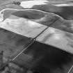
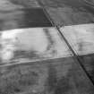
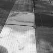
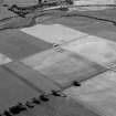
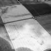
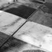
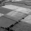
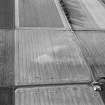
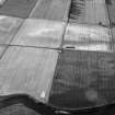
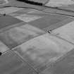
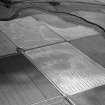
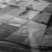
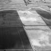
(Location cited as NJ 8133 1580 and name as Wester Fintray). Air photography (BKS vertical NJ81N 2729148, flown 1977, and GRC/AAS 1983, 1984 and 1986) has recorded cropmarks at an altitude of 50m OD. They include those of a palisaded enclosure, and may represent a homestead.
[Air photographic imagery listed].
NMRS, MS/712/36.

