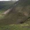
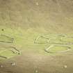
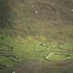
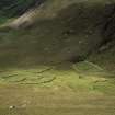
St Kilda, Hirta, An Lag Bho'n Tuath
Cultivation Remains (Post Medieval), Lazy Beds(S) (Post Medieval), Natural Feature (Period Unassigned), Turf Cutting (Post Medieval)
Site Name St Kilda, Hirta, An Lag Bho'n Tuath
Classification Cultivation Remains (Post Medieval), Lazy Beds(S) (Post Medieval), Natural Feature (Period Unassigned), Turf Cutting (Post Medieval)
Canmore ID 83042
Site Number NF19NW 26
NGR NF 10375 99526
Datum OSGB36 - NGR
Permalink http://canmore.org.uk/site/83042
- Council Western Isles
- Parish Harris
- Former Region Western Isles Islands Area
- Former District Western Isles
- Former County Inverness-shire
Excavation (1993 - 1994)
NF19NW 26 1038 9953
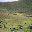
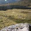
In 1993 a platform-like feature, c 14m to 15m long (AL1), lying just outside Enclosure 1 to the SSE (NF 1038 9953) and with its northern end located beneath or just inside the enclosure wall, was excavated to discover whether it was a natural feature and, if not, what its function might have been. Excavation and soil sampling suggested more an artificial bed of earth, possibly used for some type of cultivation. This season, some of the more rectangular turf-covered features inside Enclosure 2 (AL4 a, b, c) were investigated. These proved to have a considerable depth of soil, unlike the areas on the western sides of the corrie where the 'boat shapes' and cairns are located and where there is very little soil cover. These features within Enclosure 2 showed no trace of stone in their structure, and the rectangular appearance shown on the surface appears simply to be, again like AL1, a raised soil 'lip' running around the edge of each platform or bed of soil; the soil profiles also show undoubtedtip lines. Pollen and soil analysis, together with the recovery of a large rim sherd of black ware pottery from another of the earthen platforms (AL 4c; inside Enclosure 2), well below the surface, during this year's excavations, would appear to confirm the human association. A preliminary examination of the sherd suggests similarities with pottery from the excavations of a black house along the Village Street.
Sponsor: National Trust for Scotland.
A Morrison, P Johnson and A Pollard 1993; A Morrison, T Pollard and J Huntley 1994.


