
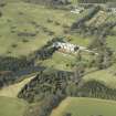
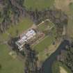
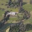
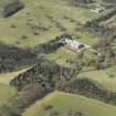
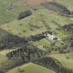
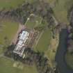
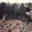
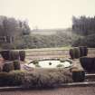
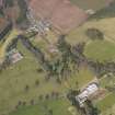
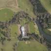
Manderston House, Terrace Garden


Fountain (Period Unassigned), Garden (Period Unassigned), Gate (Period Unassigned), Pond (Period Unassigned), Statue (Period Unassigned)
Site Name Manderston House, Terrace Garden
Classification Fountain (Period Unassigned), Garden (Period Unassigned), Gate (Period Unassigned), Pond (Period Unassigned), Statue (Period Unassigned)
Alternative Name(s) Manderston House Policies
Canmore ID 82942
Site Number NT85SW 24.04
NGR NT 81105 54354
Datum OSGB36 - NGR
Permalink http://canmore.org.uk/site/82942


- Council Scottish Borders, The
- Parish Duns
- Former Region Borders
- Former District Berwickshire
- Former County Berwickshire
NT85SW 24.04 81105 54354
Visible on Ordnance Survey air photograph 68/071/016.
(Undated) information in NMRS.

