
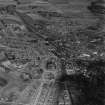
Arbroath, Goods Station


Goods Shed (19th Century) - (20th Century)
Site Name Arbroath, Goods Station
Classification Goods Shed (19th Century) - (20th Century)
Canmore ID 82296
Site Number NO64SW 109
NGR NO 6388 4108
Datum OSGB36 - NGR
Permalink http://canmore.org.uk/site/82296


- Council Angus
- Parish Arbroath And St Vigeans
- Former Region Tayside
- Former District Angus
- Former County Angus
NO64SW 109 6388 4108
See also NO64SW 108.
In the yard on the downside of Arbroath Station is a '...single-storey rubble building with 4 arched entrances, probably the engine shed of the Dundee & Arbroath and Aberdeen railways.'
J R Hume, 1977.
The Dunee and Arbroath Railway company operated services from 1838 and so this 4 bay goods station possibly dates from the 1840s based on the style of the building. The building is depicted on the Ordnance Survey 1st edition 6-inch map (Angus, 1865). The 1st edition 25-inch map (Angus, 1894) depicts three tracks and three turntables to the S of the goods shed. There is a small goods handling crane nearby (NO64SW 108).
This building was photographed by RCAHMS in 2008 due to threat of demolition.
Information from RCAHMS (MMD) 6 June 2008.
This goods station has been demolished.
Information from RCAHMS (MMD), 18 December 2008.

