Barbachlaw
Field Boundary(S) (Medieval), Pit(S) (Medieval), Rig And Furrow (Medieval) - (Post Medieval)
Site Name Barbachlaw
Classification Field Boundary(S) (Medieval), Pit(S) (Medieval), Rig And Furrow (Medieval) - (Post Medieval)
Canmore ID 82098
Site Number NT37SE 101
NGR NT 36258 71732
Datum OSGB36 - NGR
Permalink http://canmore.org.uk/site/82098
- Council East Lothian
- Parish Inveresk (East Lothian)
- Former Region Lothian
- Former District East Lothian
- Former County Midlothian
NT37SE 101 NT 36258 71732
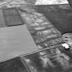
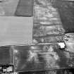
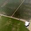
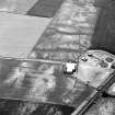
Air photographs show a series of cropmarks, including those of two possible enclosures, in a field immediately to the SW of Barbachlaw farmsteading. Two arcs of narrow ditch, possibly palisaded, form part of what may be a circular enclosure with a diameter of about 30m at NT 3618 7178. A second possible circular enclosure defined by a narrow ditch is visible at NT 3627 7169 with a diameter of about 18m. An area of rig and furrow cultivation is also revealed as cropmarking between these two possible enclosures, and there are also a series of indeterminate cropmarks in the surrounding area. Further cropmarks and an enclosures have been identified in adjacent fields (NT37SE 82, NT37SE 95, NT37SE 98 ).
Information from RCAHMS (KB) 1 April 1999
Aerial photographs taken in 1984 by C Martin, St Andrews University (84.27.9-10).
NT 3610 7180 Evaluation trial trenching in March 2002, amounting to an approximate 5% sample of a 5.9ha area of farmland to the NW of Barbachlaw Farm, failed to discover any features of archaeological significance.
The possible palisade enclosure (NT37SE 101) proved not to be present on the ground. This may be due to its destruction through continued ploughing, or the cropmarks may be geological in origin. (AOC 3762)
Archive to be deposited in the NMRS.
Sponsor: Sirius Sport & Leisure Ltd.
C Ellis (AOC) 2002
Metal Detector Survey (2005 - 2006)
NT 3621 7178 We undertook three metal detecting surveys of two fields to the immediate SW of Barbachlaw Farm during 2005 and 2006, where part of the16th-century Battle of Pinkie is believed to have taken place. This work was undertaken as part of a salvage exercise in advance of what was believed to be imminent development. The survey identified an extensive and diverse assemblage of artefacts, representing a wide range of periods from late medieval to early modern.
Archive to be deposited with RCAHMS. Report to be deposited with East Lothian and Midlothian SMR and RCAHMS.
Watching Brief (8 February 2016 - 11 February 2016)
A monitored topsoil strip of an area exploring archaeological field systems previously revealed in 2002. A metal detecting survey was also completed at the same time to scan the area for artefacts associated with the Battle of Pinkie on which the site lies on the Northern most extent.
Information from OASIS ID: aocarcha1-242644 (S Wilson) 2016


