
Pricing Change
New pricing for orders of material from this site will come into place shortly. Charges for supply of digital images, digitisation on demand, prints and licensing will be altered.
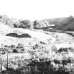
Dunbeath, Suspension Footbridge


Suspension Bridge (Period Unassigned)
Site Name Dunbeath, Suspension Footbridge
Classification Suspension Bridge (Period Unassigned)
Alternative Name(s) Burn Of Houstry Footbridge
Canmore ID 8197
Site Number ND13SE 74
NGR ND 15626 30404
Datum OSGB36 - NGR
Permalink http://canmore.org.uk/site/8197


- Council Highland
- Parish Latheron
- Former Region Highland
- Former District Caithness
- Former County Caithness
ND13SE 74 15626 30404
FB [NAT]
OS (GIS) MasterMap, April 2010.
Not to be confused with ND13SE 73.
This bridge carries a footpath over the Burn of Houstry 90m SE of Dun Beath broch (ND13SE 17).
Information from RCAHMS (RJCM), 12 April 2010.

