Scheduled Maintenance
Please be advised that this website will undergo scheduled maintenance on the following dates: •
Tuesday 3rd December 11:00-15:00
During these times, some services may be temporarily unavailable. We apologise for any inconvenience this may cause.
Flotta, Stanger Head, Port War Signal Station
Naval Signal Station (20th Century)
Site Name Flotta, Stanger Head, Port War Signal Station
Classification Naval Signal Station (20th Century)
Alternative Name(s) Scapa Flow
Canmore ID 81744
Site Number ND39SE 35
NGR ND 37343 92586
Datum OSGB36 - NGR
Permalink http://canmore.org.uk/site/81744
- Council Orkney Islands
- Parish Walls And Flotta
- Former Region Orkney Islands Area
- Former District Orkney
- Former County Orkney
ND39SE 35 37343 92586
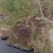
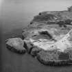
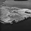
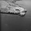
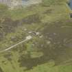
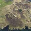
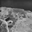
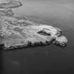
Stanger Head Naval Signal Station is situated some 300m NW of the coast battery (ND39SE 11). It consists of a long building with an observation tower in the centre. Internally many of the rooms and compartments survive, however, the stairs to the tower have been deliberately collapsed so as to deny access due to the dangerous condition of parts of the tower.
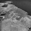
In the immediate area surrounding the station are several upstanding buildings, including generator rooms, oil storage buildings, one of which retains the oil tank within, air-raid shelters and a water tank. The associated military camp lay immediately to the N and several of the hut bases are clearly visible, two of which still retain the upstanding chimney stacks.
Immediately NE of the camp are the remains of the water collection system, a large enclosure divided into two parts surrounded by a low concrete wall, one sloping northwards to collect water the other enclosure being utilised as the reservoir, 'water was a problem on Flotta, the large artificial catchment near Stanger Head being a quite inadequate source of supply for the sudden influx of troops' (Hewison 1985). The system would appear to have been constructed using corrugated iron sheets supported by wooden posts, some of which survive, laid out to slope northwards towards the reservoir. Some of the corrugated iron sheets are still in situ at the edge of the enclosure.
Visited by RCAHMS (DE) May 1996
ND 372 924 WWII concrete post-base.
Sponsors: Historic Scoland, Orkney Archaeological Trust.
G Wilson and H Moore 1997.
Field Visit (1997)
Elements located
Stanger Battery came into being at the outbreak of WWI to guard Hoxa Sound. Initially, the battery was armed with four temporarily emplaced twelve-pounder guns. Later, these were replaced with four 4” quick fire guns in permanent concrete emplacements. In 1915 two 6” quick fire guns were added.
In 1938, in preparation for the war, the Stanger Battery was reopened with the installation of two 6” guns on temporary emplacements. By 1940, a permanent emplacement had been built and was now backed up by an additional 4.7” gun, set on a temporary emplacement nearby. This battery served to guard Hoxa and Switha Sounds.
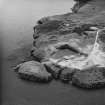
Little survives of the batteries, due in part to extensive post-war quarrying and land disturbance. Other military remains cover an extensive area, mostly located 100m or more inland. Within the coastal zone there are frequent fragments of earthworks. These possibly represent military training areas and firing ranges. The ruinous footings of concrete and brick buildings which do survive in this area are now very obscured by vegetation.
Orkney Coastal Zone Assessment 1997.


