
Pricing Change
New pricing for orders of material from this site will come into place shortly. Charges for supply of digital images, digitisation on demand, prints and licensing will be altered.
Kirkwall Airport


Airfield (20th Century), Airport (20th Century)
Site Name Kirkwall Airport
Classification Airfield (20th Century), Airport (20th Century)
Alternative Name(s) Grimsetter; Hms Robin; Kirkwall Aerodrome
Canmore ID 81648
Site Number HY40NE 27
NGR HY 4803 0821
NGR Description Centred on HY 4802 0821
Datum OSGB36 - NGR
Permalink http://canmore.org.uk/site/81648


- Council Orkney Islands
- Parish St Andrews And Deerness
- Former Region Orkney Islands Area
- Former District Orkney
- Former County Orkney
HY40NE 27.00 4802 0821
HY40NE 27.01 centred HY 48141 07789 Buildings; Nissen huts; Huts
HY40NE 27.02 HY 47515 08349 and HY 47604 08349 Aircraft Hangars; Dispersal Bays
HY40NE 27.03 centred HY 48778 08448 Aircraft Hangars; Huts
HY40NE 27.04 centred HY 48503 08044 Dispersal Bays
HY40NE 27.05 HY 48018 08021 Control Tower
HY40NE 27.06 HY 47550 07505 and HY 47677 07612 Aircraft hangars
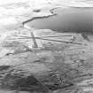
Visible on air photographs (OS 63/45/023, 112-114, flown 1963)
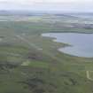
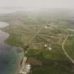
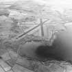
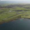
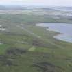
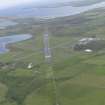
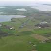
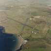
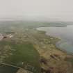
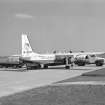
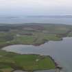
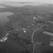
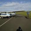
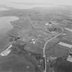
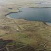
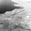
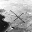
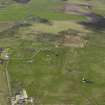
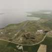
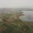
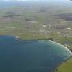
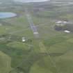
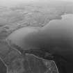
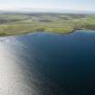
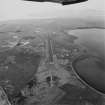
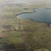
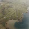
Kirkwall, or Grimsetter was a Fighter Sector Station. The large operations room can still be seen on the airport road close to the town (HY40NE 28). The airfield became a RN base in 1943 and reverted to the RAF during July 1945, it later was converted to civilian use as Kirkwall Airport for services to the mainland. Two of the naval 'S' hangars remain and the control tower is the original building with a modern glasshouse on top. Still the main airport for the Orkney Islands it is also used for the inter-island air service. Three of the wartime dispersal bays can still be seen on the E and N perimeters.
D J Smith 1983; B Quarrie 1987.
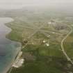
Kirkwall Airport, formerly Grimsetter or HMS Robin, is situated on level ground on the S side of Inganess Bay. Apart from the runways, little survives of the wartime structures apart from the control tower, two 'Mainhill/S' type aircraft hangars and several buldings and huts. In addition several earth banked dispersal bays with built -in air-raid shelters were noted on both the E and W sides of the airfield along with many concrete hut bases which represented the dispersed aircraft crew shelters. Type S hangars were built mainly on Royal Naval Air Service airfields and designed specifically for folding wing aircraft and had a length of 50 feet, span of 60 feet 5 ins and height of 20 feet.
Much of what was the main technical area has been completely remodelled to accommodate a modern terminal building and several modern ancilliary structures. However, one large Nissen type hut survives to the W of the modern terminal.
The airfield is visible on RAF vertical air photographs (LEU/UK2, 7117-7121, flown 16 April 1948) which shows the full extant of the wartime construction, including all the dispersed hangars.
One runway was extended in the 1960s to accommodate larger civilian aircraft.
On the date of visit (August 1999) a new control tower was under construction and once completed would render the WW II tower redundant. The intention was to demolish the old tower, but no final decision on this had been made.
Visited by RCAHMS (DE, GS), May and August 1999

