
Lamb Knowe


Enclosure (Post Medieval)
Site Name Lamb Knowe
Classification Enclosure (Post Medieval)
Canmore ID 80808
Site Number NT20SE 30
NGR NT 2522 0006
Datum OSGB36 - NGR
Permalink http://canmore.org.uk/site/80808


- Council Dumfries And Galloway
- Parish Eskdalemuir
- Former Region Dumfries And Galloway
- Former District Annandale And Eskdale
- Former County Dumfries-shire
NT20SE 30 2522 0006
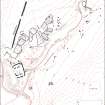
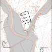
A circular enclosure, measuring about 22m in diameter within a low turf-covered bank, is situated on a flattish terrace on the SW flank of Lamb Knowe.
Visited by RCAHMS (JRS), August 1992.

