Banff, Boyndie Airfield
Airfield (20th Century)
Site Name Banff, Boyndie Airfield
Classification Airfield (20th Century)
Alternative Name(s) Woodside Of Whyntie; Springside Of Croft; Moor Of Rettie
Canmore ID 80720
Site Number NJ66SW 21
NGR NJ 6200 6440
NGR Description Centred NJ 6200 6440
Datum OSGB36 - NGR
Permalink http://canmore.org.uk/site/80720
- Council Aberdeenshire
- Parish Boyndie
- Former Region Grampian
- Former District Banff And Buchan
- Former County Banffshire
NJ66SW 21.00 centred 6200 6440
NJ66SW 21.01 NJ 62301 64221 Control Tower; Buildings (Technical site)
NJ66SW 21.02 NJ 62365 63360 Operations Block
NJ66SW 21.03 NJ 62649 64608 Firing Range
NJ66SW 21.04 NJ 61661 62365 Commemorative Monument
NJ66SW 21.05 centred NJ 62405 63859 Buildings; Parachute Packing; Store; Huts (Technical Site)
NJ66SW 21.06 centred NJ 63087 63960 Bomb Store
NJ66SW 21.07 NJ 62928 62656 Sewage Works
NJ66SW 21.08 centred NJ 62548 63156 Military Camp
NJ66SW 21.09 centred NJ 62567 63548 Military Camp
NJ66SW 21.10 centred NJ 62174 63308 Military Camp
NJ66SW 21.11 centred NJ 62200 62800 Military Camp (WAAF accommodation)
NJ66SW 21.12 centred NJ 62354 62486 Military Camp
NJ66SW 21.13 centred NJ 61675 62955 Military Camp (WAAF accommodation)
NJ66SW 21.14 centred NJ 62944 62827 Hospital
Banff, known locally as Boyndie, was built during 1942 and closed in the middle of 1946. In the operations room can be found the Strike Wing's anti-shipping 'scoreboard' along with other faded inscriptions.
D J Smith 1983; B Quarrie 1987
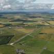
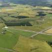
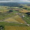
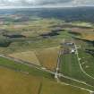
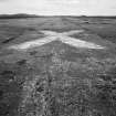
World War II airfield. Disused: part now used for agricultural purposes, part as go-cart track. Visible on air photographs AAS/94/01/G3/1-5 and AAS/94/01/G2/25-30, flown 20 January 1994. (Copies held by Grampian Regional Council).
NMRS MS/712/6 and MS/712/21.
Boyndie, disused airfield. Air photographs: AAS/00/14/G36/1-13 and AAS/00/14/CT.
NMRS, MS/712/100.
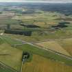
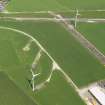
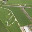
The airfield has recently been utilised for a windfarm and several large wind towers can now be seen. The wind turbines have been built along the S part of the technical site. On another part of the site ais a go-karting track whilst the W end is occupied by a small industrial estate.
Surviving buildings include the control tower, parachute packing, part of main store, many of the waist high emergency air-raid shelters, the footings and concrete bases of the hutted camps, elements of the bomb store and other indivdual buildings for example the operations block.
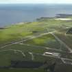
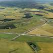
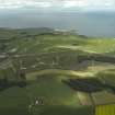
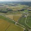
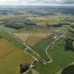
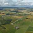
Most of the runways can still be traced, the configuration being triangular with one main E-W at 1831m and two NE-SW and NW-SE at 1037m. There are at least 28 circular hardstandings, some of which would have had 'blister' type hangars on them. Originally there were thirteen blister hangars and three T2 hangars all of which have now been removed. Adjacent to the Control Tower (NJ66SE 21.01) is a roofless brick and concrete Night Flying Equipment (NFE) store and about 388m to the S a Fabric Store, unusually set to the right of the Main Store buildings, the footings of which are still extant.
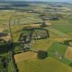
The airfield is also notable for the large number of dispersed domestic or accommodation camps, seven are visible on the postwar vertical air photographs (106G/Scoy/UK 108 , 3055-3057, flown 23 May 1946), two of which are known to have been for WAAF personnel. Many of the dispersed accommodation camps are still visible as groups of concrete hut bases.
Boyndie Airfield is visible on vertical air photographs (106G/Scot/UK 108, 3054-3057 and 4053-4056, flown 23 May 1946), which show the airfield with most of the aircraft hangars, buildings, hutted camps and ancilliary structures intact. Many of the aircraft hangars, building and hut bases are depicted as concrete platforms and hut platforms on the current OS 1:2500 digital map.
The airfield is also visible on World War II vertcial air photographs (FNO 189, 2.4-2.9, flown 13 October 1942), which show that by that date much of the infrastructure and dispersed accommodation had not been completed.
Visited by RCAHMS (DE, NG), 27 February 2008
Note (2 February 2021)
The Pillbox Study Group have recorded a number of air raid shelters from the OS 1:2500 map (1963) on the W side of the airfield. A Stanton type air raid shelter lies at NJ 6132 6441 and a number of small blast shelters were noted at NJ 6135 6431, NJ 6148 6438, NJ 6154 6422, NJ 6157 6406, NJ 6162 6389 and
NJ 6161 6350.
Information from Pillbox Study Group to HES 2 February 2021


