
Following the launch of trove.scot in February 2025 we are now planning the retiral of some of our webservices. Canmore will be switched off on 24th June 2025. Information about the closure can be found on the HES website: Retiral of HES web services | Historic Environment Scotland
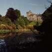
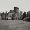
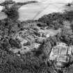
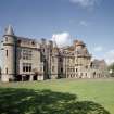
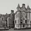
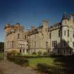
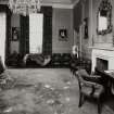
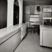
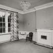
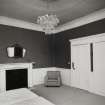
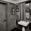
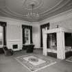
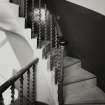
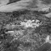
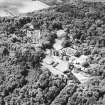
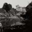
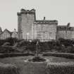
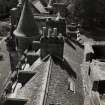
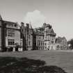
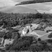
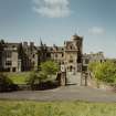
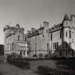
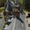
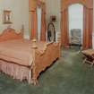
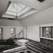
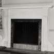
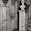
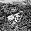
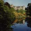
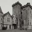
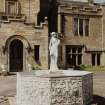
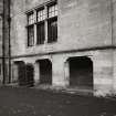
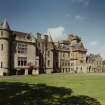
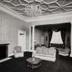
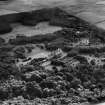
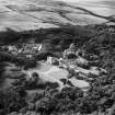
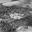
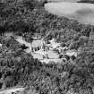
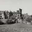
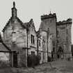
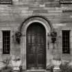
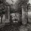
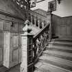
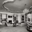
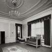
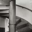
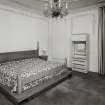
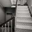
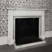
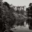
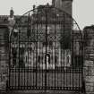
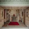
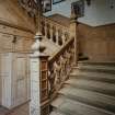
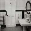
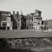
Glenapp Castle


Country House (19th Century)
Site Name Glenapp Castle
Classification Country House (19th Century)
Alternative Name(s) Glenapp Estates; Glenapp Estate; Glen App
Canmore ID 79987
Site Number NX08SE 30
NGR NX 09362 80715
Datum OSGB36 - NGR
Permalink http://canmore.org.uk/site/79987


First 100 images shown. See the Collections panel (below) for a link to all digital images.
- Council South Ayrshire
- Parish Ballantrae (Kyle And Carrick)
- Former Region Strathclyde
- Former District Kyle And Carrick
- Former County Ayrshire
NX08SE 30.00 09362 80715
NX08SE 30.01 NX 09200 80674 and NX 0916 8065 Walled Garden and Garden Cottage
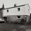
NX08SE 30.02 NX 09171 80531 Coach House, Garages and Garage Cottage
NX08SE 30.03 NX 08914 81042 Bourtreehall House
NX08SE 30.04 NX 08972 81025 Bourtreehall Cottage
NX08SE 30.05 NX 08682 81193 North Lodge
NX08SE 30.06 NX 09550 80857 Suspension Bridge (Smyrton Burn)
NX08SE 30.07 NX 09434 80501 Court House (Butler's House)
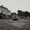
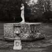
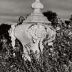
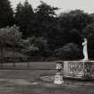
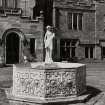
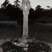
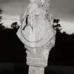
NX08SE 30.09 NX 09334 80751 Garden Sundial
See also:
NX07SE 79 NX c. 075 745 Drumanallan House
NX07SE 80 NX 05626 73373 Gamekeeper's Cottage
NX07NE 43 NX 09839 79951 Glenapp Castle, South Lodge
NX07NE 44 NX c.090 763 Proposed house for Mr Hewetson
NX07NE 46 NX 09556 77162 Carlock House, Cottage
NX18SW 49 NX 10130 80393 Smyrton, Smyrton Hill, Hall
NX18SW 50 NX 10038 80342 New Smyrton, Cottages
NMRS REFERENCE:
Architect: David Bryce 1870
Plans: Photocopies of plans in possession of Darley Hay Partnership - Photocopies plans, elevations & sections of new addition, 1929
Architect: James Bowie & Co, Ayr (1929) for Rt Hon Lord Inchcape
Plans: at Darley Hay Partnership, Ayr.
(Undated) information in NMRS.
Field Visit (26 January 2018 - 10 March 2018)
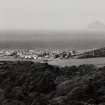
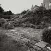
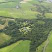
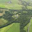
Designed garden and landscape associated with Glenapp Castle/House. Only one land parcel (278/17) is located within the designated area with the rest just lying against the boundary line.
No evidence of a designed landscape could be seen as 264, 278 and 310/17. 295/17 contained a series of curved banks. The banks were approximately 1.5m in height and concentrated in the south side of land parcel 295/17 but were not visible within the historic mapping so most likely modern. The area is marked as disused pits on the 2006 1:25000 ordinance survey, but there is no indication in the historical mapping of when the pits was in use.
Information from Oasis (rathmell1-310361) 13 June 2018

