Following the launch of trove.scot in February 2025 we are now planning the retiral of some of our webservices. Canmore will be switched off on 24th June 2025. Information about the closure can be found on the HES website: Retiral of HES web services | Historic Environment Scotland
Perth, West Railway Bridge
Railway Bridge (19th Century)
Site Name Perth, West Railway Bridge
Classification Railway Bridge (19th Century)
Alternative Name(s) Friarton Island; Moncrieffe Island; Perth Viaduct; River Tay; Tay Railway Viaduct
Canmore ID 79826
Site Number NO12SW 267
NGR NO 12130 23138
Datum OSGB36 - NGR
Permalink http://canmore.org.uk/site/79826
- Council Perth And Kinross
- Parish Perth
- Former Region Tayside
- Former District Perth And Kinross
- Former County Perthshire
NO12SW 267 12130 23138
Location formerly cited as NO 1208 2315 to NO 1218 2311.
For (associated and continuation) East Railway Bridge, see NO12SW 268.
The previous bridge was built on a curve of 15-chain radius and was of predominantly timber construction. Problems with the foundations of the structure necessitated its replacement, the new bridge being designed by the engineers of the Caledonian Rly and opened in 1863.
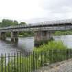
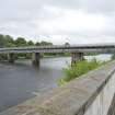
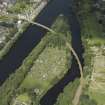
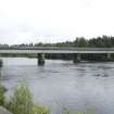
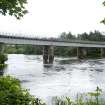
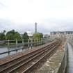
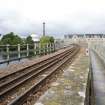
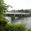
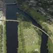
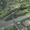
The new structure (which remains in use) was built on a slightly easier curve (of 17 chains) and was (like its predecessor) designed to carry a single track. It comprises six iron girder spans to the E of Moncrieffe Island, ten stone arches on the island itself, and seven further girder spans to the W.
M Smith 1994.
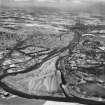
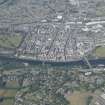
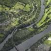
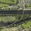
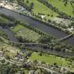
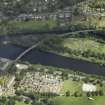
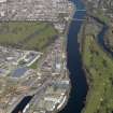
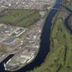
This curving bridge forms the W half of the composite structure that carries the Perth-Dundee railway line from Perth (to the W) to Barnhiil (to the E) across (in succession from the W) Shore Road, the western channel of the River Tay, Friarton or Moncrieffe Island, and the eastern channel of the River Tay. It remains in regular use by passenger traffic.
This bridge crosses the boundary between thee western channel of the River Tay, which here forms the boundary between the parishes of Perth (to the W) and Kinnoull (to the E). Friarton or Moncrieffe Island falls entirely within the parish of Kinnoull. It is depicted. but not noted, on the 1994 edition of the OS 1:10,000 map.
The location assigned to this record defines the centre of the river span. On the basis of the available map evidence, the structure may be considered to extend from NO c. 12048 23154 to NO c. 12228 23085. The defined transition point between this bridge and that (NO12SW 268) to the SE is essentially arbitrary.
Information from RCAHMS (RJCM), 31 May 2006.
Construction (1849)
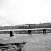
Viaduct carried the Dundee and Perth Railway across the River Tay. Timber structure on stone piers.
R Paxton and J Shipway 2007; M Martin 1994
Construction (1864)
Viaduct carrying the railway across the River Tay. Opening swing span near west bank of ther river replaced by a fixed span. 1300 feet in length, middle section founded on Moncrieffe Island. Designed by Benjamin Hall Blyth I, opened May 1864. Erected by Lee and Freeman.
R Paxton and J Shipway 2007
Project (2007)
This project was undertaken to input site information listed in 'Civil engineering heritage: Scotland - Lowlands and Borders' by R Paxton and J Shipway, 2007.
Publication Account (2007)
The first viaduct on this site, carrying the Dundee & Perth Railway across the Tay, was of bulky timber segmental arches on stone piers erected in 1849. It was replaced by the present iron and masonry viaduct opened in May 1864.
R Paxton and J Shipway
Reproduced from 'Civil Engineering heritage: Scotland - Lowlands and Borders' with kind permission of Thomas Telford Publishers.
Publication Account (2007)
The first viaduct on this site, carrying the Dundee & Perth Railway across the Tay, was of bulky timber segmental arches on stone piers erected in 1849. It was replaced by the present iron and masonry viaduct opened in May 1864, designed by B. H. Blyth [1819-1866] and erected by Lee & Freeman at a cost of about £27 000. Both bridges incorporated an opening swing-span near the west bank of the river, but in the present bridge it has since been replaced with a fixed span.
The viaduct has an overall length of about 1300 ft and is curved in plan to a radius of 15 chains (990 ft). Its middle section on Moncreiffe Island has ten masonry arches, each of 28 ft 4 in. clear span, carried on 4 ft wide piers. The adjacent sections comprising iron plate-girders spanning about 82 ft are carried on twin 712
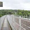
ft diameter masonry piers. The piers are founded on cast-iron caissons filled with concrete. The east section has seven spans and the west section five spans. There is a public footpath along the full length of the bridge on the north side carried on cantilevered cross beams.
R Paxton and J Shipway
Reproduced from 'Civil Engineering heritage: Scotland - Lowlands and Borders' with kind permission of Thomas Telford Publishers.


