
Inchtuthil, The Women's Knowe


Barrow (Prehistoric), Plantation Bank (Period Unknown)
Site Name Inchtuthil, The Women's Knowe
Classification Barrow (Prehistoric), Plantation Bank (Period Unknown)
Alternative Name(s) Gallows Knowe; Womens Know
Canmore ID 79584
Site Number NO13NW 7.01
NGR NO 12790 39680
Datum OSGB36 - NGR
Permalink http://canmore.org.uk/site/79584

- Council Perth And Kinross
- Parish Caputh
- Former Region Tayside
- Former District Perth And Kinross
- Former County Perthshire
Note (4 April 1989)
NO13NW 7.01 1279 3968.
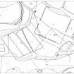
The Women's Knowe is a tree-covered mound with the remains of a plantation bank around its base; it now measures at least 16m in diameter and 1m in height.
No internal structures or finds were noted when the mound was investigated shortly before 1793, but Abercromby's narrow trench of 1901 revealed a central long cist which was aligned E-W. It contained the remains of an extended inhumation and fragments of decayed wood. The grave was covered by a mound of clayish loam (measuring up to 15.5m in diameter by 2.7m in height), and this was surrounded by a ring-ditch.
At a later date (and after material from the primary mound had begun to wash into the ditch) a capping of stone (measuring up to 0.6m in thickness) was laid over both the mound and the ditch. This capping included quarried Gourdie stone (presumably robbed from the fortress rampart) and also fragments of Roman brick or tile and (possibly) glass.
Visited by RCAHMS (JRS) 4 April 1989.
OSA 1791-9; J Abercromby, T Ross and J Anderson 1902.

