
Pricing Change
New pricing for orders of material from this site will come into place shortly. Charges for supply of digital images, digitisation on demand, prints and licensing will be altered.
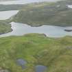
Islesburgh


Field Boundary (Period Unassigned), Field System (Period Unassigned)
Site Name Islesburgh
Classification Field Boundary (Period Unassigned), Field System (Period Unassigned)
Canmore ID 793
Site Number HU36NW 17
NGR HU 3335 6847
Datum OSGB36 - NGR
Permalink http://canmore.org.uk/site/793


- Council Shetland Islands
- Parish Northmavine
- Former Region Shetland Islands Area
- Former District Shetland
- Former County Shetland
HU36NW 17 3335 6847
Some 25 yards west of the homestead HU36NW 11, on the slopes known as Kat Field is a circular field, 130ft in diameter, which may be contemporary. It has been banked by a dyke which is now reduced to a single line of earth-fast stones at intervals.
C S T Calder 1965
A field is depicted on the 1st edition of the OS 6-inch map (Orkney & Shetland (Shetland) 1881, sheet xxix). A field wall is shown on the current edition of the OS 1:10000 map (1973).
Information from RCAHMS (SAH) 25 June 2001

