Pricing Change
New pricing for orders of material from this site will come into place shortly. Charges for supply of digital images, digitisation on demand, prints and licensing will be altered.
Settlement(S) (Period Unassigned)
Site Name Mavis Grind
Classification Settlement(S) (Period Unassigned)
Canmore ID 792
Site Number HU36NW 16
NGR HU 3372 6857
Datum OSGB36 - NGR
Permalink http://canmore.org.uk/site/792
Ordnance Survey licence number AC0000807262. All rights reserved.
Canmore Disclaimer.
© Bluesky International Limited 2025. Public Sector Viewing Terms
- Correction
- Favourite

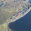
DP 145919
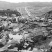
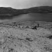
General oblique aerial view of Mavis Grind, looking W.
RCAHMS Aerial Photography Digital
22/9/2012
© Crown Copyright: HES

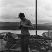
SC 1863480
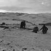
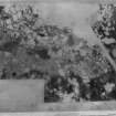
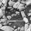
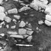
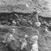
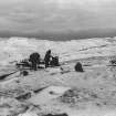
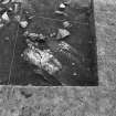
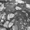
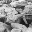
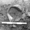
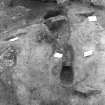
Excavation photograph (see the Black & White Register, 2nd book of MS/139/4).
Records of North of Scotland Archaeological Services, Orkney, Scotland
1978
© Courtesy of HES. Records of North of Scotland Archaeological Services, Orkney, Scotland

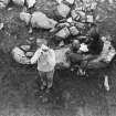
SC 1863482
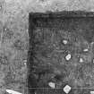
Excavation photograph (see the Black & White Register, 2nd book of MS/139/4).
Records of North of Scotland Archaeological Services, Orkney, Scotland
1978
© Courtesy of HES. Records of North of Scotland Archaeological Services, Orkney, Scotland

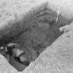
SC 1863484
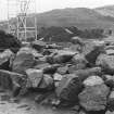
Excavation photograph (see the Black & White Register, 2nd book of MS/139/4).
Records of North of Scotland Archaeological Services, Orkney, Scotland
1978
© Courtesy of HES. Records of North of Scotland Archaeological Services, Orkney, Scotland

SC 1863492
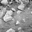
Excavation photograph (see the Black & White Register, 2nd book of MS/139/4).
Records of North of Scotland Archaeological Services, Orkney, Scotland
1978
© Courtesy of HES. Records of North of Scotland Archaeological Services, Orkney, Scotland

SC 1863508
Excavation photograph (see the Black & White Register, 2nd book of MS/139/4).
Records of North of Scotland Archaeological Services, Orkney, Scotland
1978
© Courtesy of HES. Records of North of Scotland Archaeological Services, Orkney, Scotland

SC 1863518
Excavation photograph (see the Black & White Register, 2nd book of MS/139/4).
Records of North of Scotland Archaeological Services, Orkney, Scotland
1978
© Courtesy of HES. Records of North of Scotland Archaeological Services, Orkney, Scotland

SC 1863522
Excavation photograph (see the Black & White Register, 2nd book of MS/139/4).
Records of North of Scotland Archaeological Services, Orkney, Scotland
1978
© Courtesy of HES. Records of North of Scotland Archaeological Services, Orkney, Scotland

SC 1863531
Excavation photograph (see the Black & White Register, 2nd book of MS/139/4).
Records of North of Scotland Archaeological Services, Orkney, Scotland
1978
© Courtesy of HES. Records of North of Scotland Archaeological Services, Orkney, Scotland

SC 1863535
Excavation photograph (see the Black & White Register, 2nd book of MS/139/4).
Records of North of Scotland Archaeological Services, Orkney, Scotland
1978
© Courtesy of HES. Records of North of Scotland Archaeological Services, Orkney, Scotland

SC 1863542
Excavation photograph (see the Black & White Register, 2nd book of MS/139/4).
Records of North of Scotland Archaeological Services, Orkney, Scotland
1978
© Courtesy of HES. Records of North of Scotland Archaeological Services, Orkney, Scotland

SC 1863546
Excavation photograph (see the Black & White Register, 2nd book of MS/139/4).
Records of North of Scotland Archaeological Services, Orkney, Scotland
1978
© Courtesy of HES. Records of North of Scotland Archaeological Services, Orkney, Scotland

SC 1863562
Excavation photograph (see the Black & White Register, 2nd book of MS/139/4).
Records of North of Scotland Archaeological Services, Orkney, Scotland
1978
© Courtesy of HES. Records of North of Scotland Archaeological Services, Orkney, Scotland

SC 1863575
Excavation photograph (see the Black & White Register, 2nd book of MS/139/4).
Records of North of Scotland Archaeological Services, Orkney, Scotland
1978
© Courtesy of HES. Records of North of Scotland Archaeological Services, Orkney, Scotland

SC 1863585
Excavation photograph (see the Black & White Register, 2nd book of MS/139/4).
Records of North of Scotland Archaeological Services, Orkney, Scotland
1978
© Courtesy of HES. Records of North of Scotland Archaeological Services, Orkney, Scotland

SC 1863586
Excavation photograph (see the Black & White Register, 2nd book of MS/139/4).
Records of North of Scotland Archaeological Services, Orkney, Scotland
1978
© Courtesy of HES. Records of North of Scotland Archaeological Services, Orkney, Scotland

SC 1863601
Excavation photograph (see the Black & White Register, 2nd book of MS/139/4).
Records of North of Scotland Archaeological Services, Orkney, Scotland
1978
© Courtesy of HES. Records of North of Scotland Archaeological Services, Orkney, Scotland

SC 1863604
Excavation photograph (see the Black & White Register, 2nd book of MS/139/4).
Records of North of Scotland Archaeological Services, Orkney, Scotland
1978
© Courtesy of HES. Records of North of Scotland Archaeological Services, Orkney, Scotland

SC 1863611
Excavation photograph (see the Black & White Register, 2nd book of MS/139/4).
Records of North of Scotland Archaeological Services, Orkney, Scotland
1978
© Courtesy of HES. Records of North of Scotland Archaeological Services, Orkney, Scotland

SC 1863617
Excavation photograph (see the Black & White Register, 2nd book of MS/139/4).
Records of North of Scotland Archaeological Services, Orkney, Scotland
1978
© Courtesy of HES. Records of North of Scotland Archaeological Services, Orkney, Scotland

SC 1863620
Excavation photograph (see the Black & White Register, 2nd book of MS/139/4).
Records of North of Scotland Archaeological Services, Orkney, Scotland
1978
© Courtesy of HES. Records of North of Scotland Archaeological Services, Orkney, Scotland

SC 1863622
Excavation photograph (see the Black & White Register, 2nd book of MS/139/4).
Records of North of Scotland Archaeological Services, Orkney, Scotland
1978
© Courtesy of HES. Records of North of Scotland Archaeological Services, Orkney, Scotland

SC 1863631
Excavation photograph (see the Black & White Register, 2nd book of MS/139/4).
Records of North of Scotland Archaeological Services, Orkney, Scotland
1978
© Courtesy of HES. Records of North of Scotland Archaeological Services, Orkney, Scotland

SC 1863633
Excavation photograph (see the Black & White Register, 2nd book of MS/139/4).
Records of North of Scotland Archaeological Services, Orkney, Scotland
1978
© Courtesy of HES. Records of North of Scotland Archaeological Services, Orkney, Scotland

SC 1863653
Excavation photograph (see the Black & White Register, 2nd book of MS/139/4).
Records of North of Scotland Archaeological Services, Orkney, Scotland
1978
© Courtesy of HES. Records of North of Scotland Archaeological Services, Orkney, Scotland

SC 1863662
Excavation photograph (see the Black & White Register, 2nd book of MS/139/4).
Records of North of Scotland Archaeological Services, Orkney, Scotland
1978
© Courtesy of HES. Records of North of Scotland Archaeological Services, Orkney, Scotland

SC 1863698
Excavation photograph (see the Black & White Register, 2nd book of MS/139/4).
Records of North of Scotland Archaeological Services, Orkney, Scotland
1978
© Courtesy of HES. Records of North of Scotland Archaeological Services, Orkney, Scotland

SC 1863707
Excavation photograph (see the Black & White Register, 2nd book of MS/139/4).
Records of North of Scotland Archaeological Services, Orkney, Scotland
1978
© Courtesy of HES. Records of North of Scotland Archaeological Services, Orkney, Scotland

SC 1863737
Excavation photograph (see the Black & White Register, 2nd book of MS/139/4).
Records of North of Scotland Archaeological Services, Orkney, Scotland
1978
© Courtesy of HES. Records of North of Scotland Archaeological Services, Orkney, Scotland

SC 1863750
Excavation photograph (see the Black & White Register, 2nd book of MS/139/4).
Records of North of Scotland Archaeological Services, Orkney, Scotland
1978
© Courtesy of HES. Records of North of Scotland Archaeological Services, Orkney, Scotland

SC 1863474
Excavation photograph (see the Black & White Register, 2nd book of MS/139/4).
Records of North of Scotland Archaeological Services, Orkney, Scotland
1978
© Courtesy of HES. Records of North of Scotland Archaeological Services, Orkney, Scotland

SC 1863487
Excavation photograph (see the Black & White Register, 2nd book of MS/139/4).
Records of North of Scotland Archaeological Services, Orkney, Scotland
1978
© Courtesy of HES. Records of North of Scotland Archaeological Services, Orkney, Scotland

SC 1863489
Excavation photograph (see the Black & White Register, 2nd book of MS/139/4).
Records of North of Scotland Archaeological Services, Orkney, Scotland
1978
© Courtesy of HES. Records of North of Scotland Archaeological Services, Orkney, Scotland

SC 1863493
Excavation photograph (see the Black & White Register, 2nd book of MS/139/4).
Records of North of Scotland Archaeological Services, Orkney, Scotland
1978
© Courtesy of HES. Records of North of Scotland Archaeological Services, Orkney, Scotland

SC 1863495
Excavation photograph (see the Black & White Register, 2nd book of MS/139/4).
Records of North of Scotland Archaeological Services, Orkney, Scotland
1978
© Courtesy of HES. Records of North of Scotland Archaeological Services, Orkney, Scotland

SC 1863498
Excavation photograph (see the Black & White Register, 2nd book of MS/139/4).
Records of North of Scotland Archaeological Services, Orkney, Scotland
1978
© Courtesy of HES. Records of North of Scotland Archaeological Services, Orkney, Scotland

SC 1863523
Excavation photograph (see the Black & White Register, 2nd book of MS/139/4).
Records of North of Scotland Archaeological Services, Orkney, Scotland
1978
© Courtesy of HES. Records of North of Scotland Archaeological Services, Orkney, Scotland

SC 1863524
Excavation photograph (see the Black & White Register, 2nd book of MS/139/4).
Records of North of Scotland Archaeological Services, Orkney, Scotland
1978
© Courtesy of HES. Records of North of Scotland Archaeological Services, Orkney, Scotland

SC 1863532
Excavation photograph (see the Black & White Register, 2nd book of MS/139/4).
Records of North of Scotland Archaeological Services, Orkney, Scotland
1978
© Courtesy of HES. Records of North of Scotland Archaeological Services, Orkney, Scotland

SC 1863578
Excavation photograph (see the Black & White Register, 2nd book of MS/139/4).
Records of North of Scotland Archaeological Services, Orkney, Scotland
1978
© Courtesy of HES. Records of North of Scotland Archaeological Services, Orkney, Scotland

SC 1863606
Excavation photograph (see the Black & White Register, 2nd book of MS/139/4).
Records of North of Scotland Archaeological Services, Orkney, Scotland
1978
© Courtesy of HES. Records of North of Scotland Archaeological Services, Orkney, Scotland

SC 1863624
Excavation photograph (see the Black & White Register, 2nd book of MS/139/4).
Records of North of Scotland Archaeological Services, Orkney, Scotland
1978
© Courtesy of HES. Records of North of Scotland Archaeological Services, Orkney, Scotland

SC 1863641
Excavation photograph (see the Black & White Register, 2nd book of MS/139/4).
Records of North of Scotland Archaeological Services, Orkney, Scotland
1978
© Courtesy of HES. Records of North of Scotland Archaeological Services, Orkney, Scotland

SC 1863655
Excavation photograph (see the Black & White Register, 2nd book of MS/139/4).
Records of North of Scotland Archaeological Services, Orkney, Scotland
1978
© Courtesy of HES. Records of North of Scotland Archaeological Services, Orkney, Scotland

SC 1863667
Excavation photograph (see the Black & White Register, 2nd book of MS/139/4).
Records of North of Scotland Archaeological Services, Orkney, Scotland
1978
© Courtesy of HES. Records of North of Scotland Archaeological Services, Orkney, Scotland

SC 1863669
Excavation photograph (see the Black & White Register, 2nd book of MS/139/4).
Records of North of Scotland Archaeological Services, Orkney, Scotland
1978
© Courtesy of HES. Records of North of Scotland Archaeological Services, Orkney, Scotland

SC 1863670
Excavation photograph (see the Black & White Register, 2nd book of MS/139/4).
Records of North of Scotland Archaeological Services, Orkney, Scotland
1978
© Courtesy of HES. Records of North of Scotland Archaeological Services, Orkney, Scotland

SC 1863678
Excavation photograph (see the Black & White Register, 2nd book of MS/139/4).
Records of North of Scotland Archaeological Services, Orkney, Scotland
1978
© Courtesy of HES. Records of North of Scotland Archaeological Services, Orkney, Scotland

SC 1863679
Excavation photograph (see the Black & White Register, 2nd book of MS/139/4).
Records of North of Scotland Archaeological Services, Orkney, Scotland
1978
© Courtesy of HES. Records of North of Scotland Archaeological Services, Orkney, Scotland

SC 1863680
Excavation photograph (see the Black & White Register, 2nd book of MS/139/4).
Records of North of Scotland Archaeological Services, Orkney, Scotland
1978
© Courtesy of HES. Records of North of Scotland Archaeological Services, Orkney, Scotland

SC 1863685
Excavation photograph (see the Black & White Register, 2nd book of MS/139/4).
Records of North of Scotland Archaeological Services, Orkney, Scotland
1978
© Courtesy of HES. Records of North of Scotland Archaeological Services, Orkney, Scotland

SC 1863724
Excavation photograph (see the Black & White Register, 2nd book of MS/139/4).
Records of North of Scotland Archaeological Services, Orkney, Scotland
1978
© Courtesy of HES. Records of North of Scotland Archaeological Services, Orkney, Scotland

SC 1863739
Excavation photograph (see the Black & White Register, 2nd book of MS/139/4).
Records of North of Scotland Archaeological Services, Orkney, Scotland
1978
© Courtesy of HES. Records of North of Scotland Archaeological Services, Orkney, Scotland

SC 1863743
Excavation photograph (see the Black & White Register, 2nd book of MS/139/4).
Records of North of Scotland Archaeological Services, Orkney, Scotland
1978
© Courtesy of HES. Records of North of Scotland Archaeological Services, Orkney, Scotland

SC 1863757
Excavation photograph (see the Black & White Register, 2nd book of MS/139/4).
Records of North of Scotland Archaeological Services, Orkney, Scotland
1978
© Courtesy of HES. Records of North of Scotland Archaeological Services, Orkney, Scotland

SC 1863758
Excavation photograph (see the Black & White Register, 2nd book of MS/139/4).
Records of North of Scotland Archaeological Services, Orkney, Scotland
1978
© Courtesy of HES. Records of North of Scotland Archaeological Services, Orkney, Scotland

DP 145918
General oblique aerial view of Islesburgh, looking NNW.
RCAHMS Aerial Photography Digital
22/9/2012
© Crown Copyright: HES

SC 1863470
Excavation photograph (see the Black & White Register, 2nd book of MS/139/4).
Records of North of Scotland Archaeological Services, Orkney, Scotland
1978
© Courtesy of HES. Records of North of Scotland Archaeological Services, Orkney, Scotland

SC 1863478
Excavation photograph (see the Black & White Register, 2nd book of MS/139/4).
Records of North of Scotland Archaeological Services, Orkney, Scotland
1978
© Courtesy of HES. Records of North of Scotland Archaeological Services, Orkney, Scotland

SC 1863479
Excavation photograph (see the Black & White Register, 2nd book of MS/139/4).
Records of North of Scotland Archaeological Services, Orkney, Scotland
1978
© Courtesy of HES. Records of North of Scotland Archaeological Services, Orkney, Scotland

SC 1863483
Excavation photograph (see the Black & White Register, 2nd book of MS/139/4).
Records of North of Scotland Archaeological Services, Orkney, Scotland
1978
© Courtesy of HES. Records of North of Scotland Archaeological Services, Orkney, Scotland

SC 1863503
Excavation photograph (see the Black & White Register, 2nd book of MS/139/4).
Records of North of Scotland Archaeological Services, Orkney, Scotland
1978
© Courtesy of HES. Records of North of Scotland Archaeological Services, Orkney, Scotland

SC 1863510
Excavation photograph (see the Black & White Register, 2nd book of MS/139/4).
Records of North of Scotland Archaeological Services, Orkney, Scotland
1978
© Courtesy of HES. Records of North of Scotland Archaeological Services, Orkney, Scotland

SC 1863511
Excavation photograph (see the Black & White Register, 2nd book of MS/139/4).
Records of North of Scotland Archaeological Services, Orkney, Scotland
1978
© Courtesy of HES. Records of North of Scotland Archaeological Services, Orkney, Scotland

SC 1863514
Excavation photograph (see the Black & White Register, 2nd book of MS/139/4).
Records of North of Scotland Archaeological Services, Orkney, Scotland
1978
© Courtesy of HES. Records of North of Scotland Archaeological Services, Orkney, Scotland

SC 1863520
Excavation photograph (see the Black & White Register, 2nd book of MS/139/4).
Records of North of Scotland Archaeological Services, Orkney, Scotland
1978
© Courtesy of HES. Records of North of Scotland Archaeological Services, Orkney, Scotland

SC 1863553
Excavation photograph (see the Black & White Register, 2nd book of MS/139/4).
Records of North of Scotland Archaeological Services, Orkney, Scotland
1978
© Courtesy of HES. Records of North of Scotland Archaeological Services, Orkney, Scotland

SC 1863566
Excavation photograph (see the Black & White Register, 2nd book of MS/139/4).
Records of North of Scotland Archaeological Services, Orkney, Scotland
1978
© Courtesy of HES. Records of North of Scotland Archaeological Services, Orkney, Scotland

SC 1863568
Excavation photograph (see the Black & White Register, 2nd book of MS/139/4).
Records of North of Scotland Archaeological Services, Orkney, Scotland
1978
© Courtesy of HES. Records of North of Scotland Archaeological Services, Orkney, Scotland

SC 1863569
Excavation photograph (see the Black & White Register, 2nd book of MS/139/4).
Records of North of Scotland Archaeological Services, Orkney, Scotland
1978
© Courtesy of HES. Records of North of Scotland Archaeological Services, Orkney, Scotland

SC 1863572
Excavation photograph (see the Black & White Register, 2nd book of MS/139/4).
Records of North of Scotland Archaeological Services, Orkney, Scotland
1978
© Courtesy of HES. Records of North of Scotland Archaeological Services, Orkney, Scotland

SC 1863574
Excavation photograph (see the Black & White Register, 2nd book of MS/139/4).
Records of North of Scotland Archaeological Services, Orkney, Scotland
1978
© Courtesy of HES. Records of North of Scotland Archaeological Services, Orkney, Scotland

SC 1863581
Excavation photograph (see the Black & White Register, 2nd book of MS/139/4).
Records of North of Scotland Archaeological Services, Orkney, Scotland
1978
© Courtesy of HES. Records of North of Scotland Archaeological Services, Orkney, Scotland

SC 1863584
Excavation photograph (see the Black & White Register, 2nd book of MS/139/4).
Records of North of Scotland Archaeological Services, Orkney, Scotland
1978
© Courtesy of HES. Records of North of Scotland Archaeological Services, Orkney, Scotland

SC 1863591
Excavation photograph (see the Black & White Register, 2nd book of MS/139/4).
Records of North of Scotland Archaeological Services, Orkney, Scotland
1978
© Courtesy of HES. Records of North of Scotland Archaeological Services, Orkney, Scotland

SC 1863592
Excavation photograph (see the Black & White Register, 2nd book of MS/139/4).
Records of North of Scotland Archaeological Services, Orkney, Scotland
1978
© Courtesy of HES. Records of North of Scotland Archaeological Services, Orkney, Scotland

SC 1863593
Excavation photograph (see the Black & White Register, 2nd book of MS/139/4).
Records of North of Scotland Archaeological Services, Orkney, Scotland
1978
© Courtesy of HES. Records of North of Scotland Archaeological Services, Orkney, Scotland

SC 1863602
Excavation photograph (see the Black & White Register, 2nd book of MS/139/4).
Records of North of Scotland Archaeological Services, Orkney, Scotland
1978
© Courtesy of HES. Records of North of Scotland Archaeological Services, Orkney, Scotland

SC 1863608
Excavation photograph (see the Black & White Register, 2nd book of MS/139/4).
Records of North of Scotland Archaeological Services, Orkney, Scotland
1978
© Courtesy of HES. Records of North of Scotland Archaeological Services, Orkney, Scotland

SC 1863619
Excavation photograph (see the Black & White Register, 2nd book of MS/139/4).
Records of North of Scotland Archaeological Services, Orkney, Scotland
1978
© Courtesy of HES. Records of North of Scotland Archaeological Services, Orkney, Scotland

SC 1863625
Excavation photograph (see the Black & White Register, 2nd book of MS/139/4).
Records of North of Scotland Archaeological Services, Orkney, Scotland
1978
© Courtesy of HES. Records of North of Scotland Archaeological Services, Orkney, Scotland

SC 1863635
Excavation photograph (see the Black & White Register, 2nd book of MS/139/4).
Records of North of Scotland Archaeological Services, Orkney, Scotland
1978
© Courtesy of HES. Records of North of Scotland Archaeological Services, Orkney, Scotland

SC 1863647
Excavation photograph (see the Black & White Register, 2nd book of MS/139/4).
Records of North of Scotland Archaeological Services, Orkney, Scotland
1978
© Courtesy of HES. Records of North of Scotland Archaeological Services, Orkney, Scotland

SC 1863652
Excavation photograph (see the Black & White Register, 2nd book of MS/139/4).
Records of North of Scotland Archaeological Services, Orkney, Scotland
1978
© Courtesy of HES. Records of North of Scotland Archaeological Services, Orkney, Scotland

SC 1863654
Excavation photograph (see the Black & White Register, 2nd book of MS/139/4).
Records of North of Scotland Archaeological Services, Orkney, Scotland
1978
© Courtesy of HES. Records of North of Scotland Archaeological Services, Orkney, Scotland

SC 1863666
Excavation photograph (see the Black & White Register, 2nd book of MS/139/4).
Records of North of Scotland Archaeological Services, Orkney, Scotland
1978
© Courtesy of HES. Records of North of Scotland Archaeological Services, Orkney, Scotland

SC 1863675
Excavation photograph (see the Black & White Register, 2nd book of MS/139/4).
Records of North of Scotland Archaeological Services, Orkney, Scotland
1978
© Courtesy of HES. Records of North of Scotland Archaeological Services, Orkney, Scotland

SC 1863677
Excavation photograph (see the Black & White Register, 2nd book of MS/139/4).
Records of North of Scotland Archaeological Services, Orkney, Scotland
1978
© Courtesy of HES. Records of North of Scotland Archaeological Services, Orkney, Scotland

SC 1863683
Excavation photograph (see the Black & White Register, 2nd book of MS/139/4).
Records of North of Scotland Archaeological Services, Orkney, Scotland
1978
© Courtesy of HES. Records of North of Scotland Archaeological Services, Orkney, Scotland

SC 1863695
Excavation photograph (see the Black & White Register, 2nd book of MS/139/4).
Records of North of Scotland Archaeological Services, Orkney, Scotland
1978
© Courtesy of HES. Records of North of Scotland Archaeological Services, Orkney, Scotland

SC 1863697
Excavation photograph (see the Black & White Register, 2nd book of MS/139/4).
Records of North of Scotland Archaeological Services, Orkney, Scotland
1978
© Courtesy of HES. Records of North of Scotland Archaeological Services, Orkney, Scotland

SC 1863700
Excavation photograph (see the Black & White Register, 2nd book of MS/139/4).
Records of North of Scotland Archaeological Services, Orkney, Scotland
1978
© Courtesy of HES. Records of North of Scotland Archaeological Services, Orkney, Scotland

SC 1863708
Excavation photograph (see the Black & White Register, 2nd book of MS/139/4).
Records of North of Scotland Archaeological Services, Orkney, Scotland
1978
© Courtesy of HES. Records of North of Scotland Archaeological Services, Orkney, Scotland

SC 1863715
Excavation photograph (see the Black & White Register, 2nd book of MS/139/4).
Records of North of Scotland Archaeological Services, Orkney, Scotland
1978
© Courtesy of HES. Records of North of Scotland Archaeological Services, Orkney, Scotland

SC 1863733
Excavation photograph (see the Black & White Register, 2nd book of MS/139/4).
Records of North of Scotland Archaeological Services, Orkney, Scotland
1978
© Courtesy of HES. Records of North of Scotland Archaeological Services, Orkney, Scotland

SC 1863734
Excavation photograph (see the Black & White Register, 2nd book of MS/139/4).
Records of North of Scotland Archaeological Services, Orkney, Scotland
1978
© Courtesy of HES. Records of North of Scotland Archaeological Services, Orkney, Scotland

SC 1863742
Excavation photograph (see the Black & White Register, 2nd book of MS/139/4).
Records of North of Scotland Archaeological Services, Orkney, Scotland
1978
© Courtesy of HES. Records of North of Scotland Archaeological Services, Orkney, Scotland

SC 1863749
Excavation photograph (see the Black & White Register, 2nd book of MS/139/4).
Records of North of Scotland Archaeological Services, Orkney, Scotland
1978
© Courtesy of HES. Records of North of Scotland Archaeological Services, Orkney, Scotland

SC 1863755
Excavation photograph (see the Black & White Register, 2nd book of MS/139/4).
Records of North of Scotland Archaeological Services, Orkney, Scotland
1978
© Courtesy of HES. Records of North of Scotland Archaeological Services, Orkney, Scotland

SC 1863763
Excavation photograph (see the Black & White Register, 2nd book of MS/139/4).
Records of North of Scotland Archaeological Services, Orkney, Scotland
1978
© Courtesy of HES. Records of North of Scotland Archaeological Services, Orkney, Scotland




































First 100 images shown. See the Collections panel (below) for a link to all digital images.
- Council Shetland Islands
- Parish Northmavine
- Former Region Shetland Islands Area
- Former District Shetland
- Former County Shetland
HU36NW 16 3372 6857 to 3383 6858
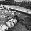
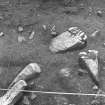
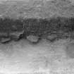
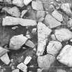
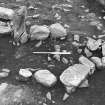
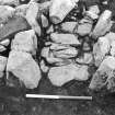
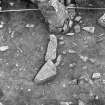
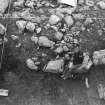
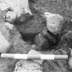
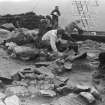
Stone structures noticed protruding from the slopes of Virdins Hill in 1973 (P Ashmore). Survey and trial excavations took place in 1978 (Cracknell & Smith). The excavations revealed a stone house and showed that it was oval, 13m x 10m, with an interior about 7m in diameter. In the first occupation phase the entrance was on the SE side. During the second phase this entrance was replaced with one to the NE and the interior was partitioned. The roof was supported on wooden posts. After the building was abandoned it was covered with peat-ash which was subsequently ploughed. There were numerous finds of steatite-tempered pottery and stone implements, which dated the site to late BA/early IA.
The second settlement, Site B, lay by the shore of the voe and consisted of two possible stone-built houses and a field system. Two trenches were dug across the structures. Although damaged in recent years it was in no further danger.
S Cracknell & B Smith (NOSAS), GAJ vol.10, 1983
Excavation (1978)
Stone structures noticed protruding from the slopes of Virdins Hill in 1973 (P Ashmore). Survey and trial excavations took place in 1978 (Cracknell & Smith). The excavations revealed a stone house and showed that it was oval, 13m x 10m, with an interior about 7m in diameter. In the first occupation phase the entrance was on the SE side. During the second phase this entrance was replaced with one to the NE and the interior was partitioned. The roof was supported on wooden posts. After the building was abandoned it was covered with peat-ash which was subsequently ploughed. There were numerous finds of steatite-tempered pottery and stone implements, which dated the site to late BA/early IA.
The second settlement, Site B, lay by the shore of the voe and consisted of two possible stone-built houses and a field system. Two trenches were dug across the structures. Although damaged in recent years it was in no further danger.
S Cracknell & B Smith (NOSAS), GAJ vol.10, 1983


