
West Lethans


Industrial Landscape (Post Medieval)
Site Name West Lethans
Classification Industrial Landscape (Post Medieval)
Canmore ID 79127
Site Number NT09SE 20
NGR NT 055 944
NGR Description Centred NT 055 944
Datum OSGB36 - NGR
Permalink http://canmore.org.uk/site/79127

- Council Fife
- Parish Dunfermline
- Former Region Fife
- Former District Dunfermline
- Former County Fife
Field Visit (2 June 1992)
NT09SE 20.00 055 944 centred 055 944
NT09SE 20.01 NT 055 944 Coal Mine; Buildings (Cleish91 514)
NT09SE 20.02 NT 0535 9447 Ironstone Mine; Coal Mine; Rig (Cleish91 54-5, 515)
NT09SE 20.03 NT 054 948 Coal Mines (Cleish91 56, 518)
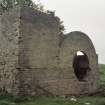
There is a group of ironstone and coal mines, with their associated spoil tips and buildings, lying to the W of Knockhill Racing Circuit. Depicted on the 1st edition of the OS 6-inch (Fife & Kinross, 1856, sheet xxix) as several small coal and ironstone pits, they had, by the the 1915 revision of the 2nd edition 25-inch map, (Fifeshire, 1915, sheet xxxiii.3) become West Lethans Pit No.1, with many of the other small pits depicted as derelict.
(Cleish91 49-55, 514-15, 518)
Visited by RCAHMS (DE, AK, KM) 2 June 1992.

