Pricing Change
New pricing for orders of material from this site will come into place shortly. Charges for supply of digital images, digitisation on demand, prints and licensing will be altered.
Upcoming Maintenance
Please be advised that this website will undergo scheduled maintenance on the following dates:
Thursday, 9 January: 11:00 AM - 3:00 PM
Thursday, 23 January: 11:00 AM - 3:00 PM
Thursday, 30 January: 11:00 AM - 3:00 PM
During these times, some functionality such as image purchasing may be temporarily unavailable. We apologise for any inconvenience this may cause.
Glenhouses
Hut Circle(S) (Prehistoric)
Site Name Glenhouses
Classification Hut Circle(S) (Prehistoric)
Alternative Name(s) Long Glen; Tore Of Troup; Longglen South
Canmore ID 78950
Site Number NJ86SW 17
NGR NJ 839 608
NGR Description Centred NJ 839 608
Datum OSGB36 - NGR
Permalink http://canmore.org.uk/site/78950
- Council Aberdeenshire
- Parish Aberdour (Banff And Buchan)
- Former Region Grampian
- Former District Banff And Buchan
- Former County Aberdeenshire
NJ86SW 17 centred 839 608.
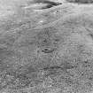
Situated on a plateau to the SE of the Tore of Troup, 300m S of promontory fort NJ86SW 8 and NJ86SW 1100 m S of Glenhouses are at least three hut-circles. Slight traces of other, probably associated, structures lie close by.
Information from Historic Scotland, March 1994.
(Location cited as NJ 840 608 and name as Long Glen). Air photography (AAS/81/11/S11/15-16) has recorded a hut-circle on the crown of a ridge in an area of heather moor at an altitude of 165m OD. It measures 7m in diameter within a bank spread to a thickness of 2.5m.
NMRS, MS/712/36, visited 9 April 1981.


