|
All Other |
B 72873 TR |
RCAHMS Aerial Transcription |
Transcription |
1992 |
Item Level |
|
|
Photographs and Off-line Digital Images |
B 72873 |
RCAHMS Aerial Photography |
Oblique aerial view. |
1992 |
Item Level |
|
|
Photographs and Off-line Digital Images |
B 84345 CS |
RCAHMS Aerial Photography |
Oblique aerial view. |
1992 |
Item Level |
|
|
Prints and Drawings |
DC 27452 PO |
RCAHMS Aerial Transcription |
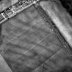
Inked transcription. |
1993 |
Item Level |
|
|
Prints and Drawings |
DC 27452 |
RCAHMS Aerial Transcription |
Inked transcription. |
1993 |
Item Level |
|
|
Photographs and Off-line Digital Images |
C 46644 |
RCAHMS Aerial Photography |
Dunragit, oblique aerial view, taken from the NNE, showing an area defined as a cropmark complex. |
29/3/1995 |
Item Level |
|
|
Photographs and Off-line Digital Images |
C 46645 |
RCAHMS Aerial Photography |
Dunragit, oblique aerial view, taken from the NNE, showing an area defined as a cropmark complex. |
29/3/1995 |
Item Level |
|
|
Photographs and Off-line Digital Images |
C 46646 |
RCAHMS Aerial Photography |
Dunragit, oblique aerial view, taken from the SE, centred on an area defined as a cropmark complex. Cropmarks of a roman road and quarry pits are visible in the top right-hand corner of the photograph. |
29/3/1995 |
Item Level |
|
|
Photographs and Off-line Digital Images |
E 98263 CS |
RCAHMS Aerial Photography |
Oblique aerial view centred on the excavation of the pit-defined enclosure, taken from the S. |
24/8/1999 |
Item Level |
|
|
Photographs and Off-line Digital Images |
E 98265 CS |
RCAHMS Aerial Photography |
Oblique aerial view centred on the excavation of the pit-defined enclosure, taken from the NE. |
24/8/1999 |
Item Level |
|
 |
On-line Digital Images |
SC 461301 |
RCAHMS Aerial Photography |
Oblique aerial view centred on the excavation of the pit-defined enclosure at Dunragit, taken from the S. |
24/8/1999 |
Item Level |
|
 |
On-line Digital Images |
SC 461306 |
RCAHMS Aerial Photography |
Oblique aerial view centred on the excavation of the pit-defined enclosure at Dunragit, taken from the NW. |
24/8/1999 |
Item Level |
|
 |
On-line Digital Images |
SC 587119 |
RCAHMS Aerial Photography |
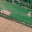
Oblique aerial view centred on the cropmark complex, taken from the SE. |
1992 |
Item Level |
|
|
Photographs and Off-line Digital Images |
D 14255 |
RCAHMS Aerial Photography |
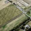
Oblique aerial photograph of Parkneuk taken from the W, centred on the cropmarks of barrows and pits, with possible quarry pits of a Roman road and the line of a military road to the left and the Dunragit cropmark complex in the top right corner of the photograph. |
14/7/1997 |
Item Level |
|
|
Photographs and Off-line Digital Images |
D 14258 |
RCAHMS Aerial Photography |
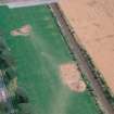
Oblique aerial photograph of Dunragit taken from the WNW, centred on a cropmark complex. |
14/7/1997 |
Item Level |
|
|
Photographs and Off-line Digital Images |
D 14259 |
RCAHMS Aerial Photography |
Oblique aerial photograph of Dunragit taken from the WSW, centred on a cropmark complex. |
14/7/1997 |
Item Level |
|
|
Photographs and Off-line Digital Images |
D 14260 |
RCAHMS Aerial Photography |
Oblique aerial photograph of Dunragit taken from the SSW, centred on a cropmark complex. |
14/7/1997 |
Item Level |
|
|
Photographs and Off-line Digital Images |
D 14261 |
RCAHMS Aerial Photography |
Oblique aerial photograph of Dunragit taken from the SSE, centred on a cropmark complex. |
14/7/1997 |
Item Level |
|
 |
On-line Digital Images |
SC 925223 |
RCAHMS Aerial Photography |
Oblique aerial view. |
1992 |
Item Level |
|
|
Manuscripts |
MS 840/768 |
RCAHMS Aerial Transcription |
Transcription file. |
22/9/1992 |
Item Level |
|
|
Photographs and Off-line Digital Images |
D 60081 |
RCAHMS Aerial Photography |
Oblique aerial view centred on the excavation of the pit-defined enclosure, taken from the ENE. |
24/8/1999 |
Item Level |
|
|
Photographs and Off-line Digital Images |
D 60082 |
RCAHMS Aerial Photography |
Oblique aerial view centred on the excavation of the pit-defined enclosure, taken from the NNE. |
24/8/1999 |
Item Level |
|
|
Photographs and Off-line Digital Images |
D 60083 |
RCAHMS Aerial Photography |
Oblique aerial view centred on the excavation of the pit-defined enclosure, taken from the NW. |
24/8/1999 |
Item Level |
|
|
Photographs and Off-line Digital Images |
D 60084 |
RCAHMS Aerial Photography |
Oblique aerial view centred on the excavation of the pit-defined enclosure, taken from the S. |
24/8/1999 |
Item Level |
|