
Loch Duntelchaig


Township (Post Medieval)
Site Name Loch Duntelchaig
Classification Township (Post Medieval)
Alternative Name(s) Baille
Canmore ID 78812
Site Number NH63SW 74
NGR NH 6047 3100
Datum OSGB36 - NGR
Permalink http://canmore.org.uk/site/78812


- Council Highland
- Parish Dores
- Former Region Highland
- Former District Inverness
- Former County Inverness-shire
Field Visit (21 October 1992)
NH63SW 74 6047 3100.
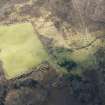
This township, which is situated on the NW side of Loch Duntelchaig beside an improved field, comprises five rectangular buildings. The buildings range in size from 7.4m to 12.3m in length by between 2.6m and 3.7m in breadth within faced-rubble walls measuring from 0.8m to 1m in thickness and standing up to 1.1m in height. Each building has a side entrance. Two of the buildings are sub-divided; one has three compartments and an extension to the NE (6.2m in length), and the other has two unequal compartments with an opening in the NE end (USN93 146 and 147 respectively), whilst there is an outshot on the back of a third building with a separate entrance in its NE side (USN93 150). One of the buildings depicted as unroofed on the 1st edition of of the OS 6- map (Inverness-shire, 1875, sheet xxx) has an embanked NW end and a drain cut around it on the NE side (USN93 148).
Four of the buildings were roofed on the 1st edition of the OS 6-inch map (Inverness-shire, 1875, sheet xxx) when the settlement was known by the name of Baille, but all were abandoned by the 2nd edition of the OS 6-inch map (Inverness-shire 1905, sheet xxx). The Name Book describes the settlement as 'a crofter's house one storey high, with outbuildings; the whole thatched...' (ONB 1871).
(USN93 146-50)
Visited by RCAHMS (PJD) 21 October 1992.

