
Pricing Change
New pricing for orders of material from this site will come into place shortly. Charges for supply of digital images, digitisation on demand, prints and licensing will be altered.
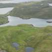
Islesburgh


Settlement (Period Unassigned), Structure (Period Unassigned)
Site Name Islesburgh
Classification Settlement (Period Unassigned), Structure (Period Unassigned)
Canmore ID 787
Site Number HU36NW 11
NGR HU 3336 6848
Datum OSGB36 - NGR
Permalink http://canmore.org.uk/site/787


- Council Shetland Islands
- Parish Northmavine
- Former Region Shetland Islands Area
- Former District Shetland
- Former County Shetland
HU36NW 11 3336 6848
(HU 3337 6894) The remains of a Neolithic house, partially excavated by Calder between 1956 and 1963, comprising a wall 7' to 8 1/2' thick, surrounding an oval hollow. A superimposed plantie-crub (probably built from the stone of the house) prevented the excavation of the southern half of the house which probably contained the entrance. The floor was paved with slabs which also acted as cover-stones for a well constructed drain. The finds now in the National Museum of Antiquties of Scotland (NMAS), included parts of steatite vessels, as well as the usual stone implements (Proc Soc Antiq Scot 1962).
On a slight terrace in front of the house are four well set earth-fast stones, on the line of the crest, probably the remains of a small field annexe.
The remains of the published wall around the site are now ruinous, but of unusual strength measuring 4'-5' in thickness and rising to a maximum height of nearly 5'. Any walling on the seaward side of the enclosure has been destroyed by coastal erosions.
The site lies in a sheltered position at the foot of surrounding hill-slopes and that the enclosure has been cultivated is evidenced by its good pasture land as well as by three old and large heaps of field gathered stones which have been dumped just outside the wall on the NE. A stream running down the outside of the west wall has ensured a convenient water supply.
C S T Calder 1965
As described and planned by Calder.
Ne House-site surveyed at 6".
Visited by OS(WDJ) 27th May 1968
One unroofed structure, possibly the planti-crub described above, is depicted on the 1st edition of the OS 6-inch map (Orkney & Shetland (Shetland) 1881, sheet xxix) and on the current edition of the OS 1:10000 map (1973).
Information from RCAHMS (SAH) 25 June 2001

