Pricing Change
New pricing for orders of material from this site will come into place shortly. Charges for supply of digital images, digitisation on demand, prints and licensing will be altered.
Glasgow, Shawfield Road, Shawfield Stadium
Football Ground (19th Century) - (20th Century), Stadium (20th Century)
Site Name Glasgow, Shawfield Road, Shawfield Stadium
Classification Football Ground (19th Century) - (20th Century), Stadium (20th Century)
Alternative Name(s) Glasgow Road; Shawfield Drive; Rutherglen Road
Canmore ID 78679
Site Number NS66SW 97
NGR NS 60514 62805
NGR Description Centred NS 60514 62805
Datum OSGB36 - NGR
Permalink http://canmore.org.uk/site/78679
- Council South Lanarkshire
- Parish Rutherglen (South Lanarkshire)
- Former Region Strathclyde
- Former District City Of Glasgow
- Former County Lanarkshire
NS66SW 97 centred 60514 62805
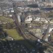
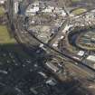
Greyhound racing stadium on the W side of Shawfield Road and bounded by Rutherglan Road, Shawfield Drive and Glasgow Road. Main grandstand on W side of playing area, covered terracing on all sides except the S. Dog track between terracing and the playing area.
Former home of Clyde Football Club who now play at Broadwood Stadium, Cumbernauld.
Field Visit (1 March 2012 - 1 June 2012)
A site visit recorded the stadium as having an asbestos roof with steel cladding and rendered brick facing.
Information from OASIS Id: cfaarcha1-192574 (G Mudie) 2012
Desk Based Assessment (1 March 2012 - 1 June 2012)
A football ground and greyhound racing stadium is recorded by the NMRS and HER on the west side of Shawfield Road. The main grandstand is on the west side of the playing area, with covered terracing on all sides except the southern side. The stadium is the former home of Clyde Football club.
The stadium is first depicted on the 1914 Ordnance Survey map, and is shown on all subsequent Ordnance Survey Editions.
Information from OASIS Id: cfaarcha1-192574 (G Mudie) 2012
Note (27 October 2023)
Shawfield was built in 1898 as a football ground and grandstand for Clyde Football Club (Clyde FC). The stadium was adapted to include greyhound racing and other sports in 1932. The grandstand and structures were upgraded in 1936 by John Easton in an Art Deco style. The site now comprises a grassed oval playing field surrounded by an oval racing track and bounded by an outer wall, largely of brick construction. The former greyhound track is 432m in length. Tiered spectator stands, dating from 1898, extend around the northern and eastern lengths of the track. These have trussed-metal roof structures, probably dating from around 1936.
There is a large, covered grandstand and entrance range to the west with associated bar, restaurants and entertainment facilities largely dating to the early 1930's and upgraded in the latter decades of the 20th century. Shawfield Stadium is bounded by Rutherglen Road (A730), Shawfield Drive (A728) and Shawfield Road.
The 1930's grandstand range is located along the western side of the track with timber stairs, iron columns and tiered spectator areas. The top level of the grandstand has bar and refreshment facilities with windows overlooking the racetrack. There is a press box on stilts within the grandstand at ground floor level and a betting ring attached to the southern end of the main grandstand with a bar and restaurant (south bar) above. A 1980s two-storey, brick-built snack and café bar (north bar) is attached to the northern end of the grandstand.
The windows in the western (street) side of the grandstand are in a mixture of glazing patterns in metal casement frames. The main grandstand (to the west) and tiered spectator stands (to the north and east) are covered in corrugated roofing material, some of which is asbestos sheeting. The remainder of the buildings onsite are multi-phase ranging from the 1930's to the early 2000's and are predominantly flat roofed in a variety of materials.
The restaurant and bar interiors largely date from the 1980's and 1990's and include typical features, such as plastic tables, chairs and hard-wearing floor coverings. The betting ring has a painted brick interior with eight stalls for placing bets. Some 1930's Art Deco-style features remain within the main grandstand, including door handles, handrails and some painted decorative schemes within the office areas and stairwells.
The Shawfield site is bounded by brick-built walls of varying heights, some of which are rendered. Those nearest the main entrance are topped by iron railings. Low quadrant walls and low, squared gate piers mark the main (west) entrance to the site at the intersection of Rutherglen Road and Shawfield Drive. The rear (north) extent of the site has stepped boundary walls with letters above reading “SHAWFIELD”. There are some narrow, former turnstile openings along Shawfield Road.
There is a rectangular-plan, timber-constructed building with a canopy, probably related to the original suite of kennels (which are now gone) and likely dating to around 1932, at the southern extent of the site. A later, large, corrugated shed with double door openings is located next to this earlier building.
Information from HES (2024)


