Pricing Change
New pricing for orders of material from this site will come into place shortly. Charges for supply of digital images, digitisation on demand, prints and licensing will be altered.
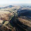
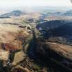
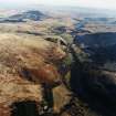
Eastplace Burn
Enclosure(S) (Medieval) - (Post Medieval), Field System (Medieval) - (Post Medieval), Head Dyke(S) (Post Medieval), Quarry (Post Medieval), Rig And Furrow (Medieval) - (Post Medieval)
Site Name Eastplace Burn
Classification Enclosure(S) (Medieval) - (Post Medieval), Field System (Medieval) - (Post Medieval), Head Dyke(S) (Post Medieval), Quarry (Post Medieval), Rig And Furrow (Medieval) - (Post Medieval)
Alternative Name(s) Ben Thrush
Canmore ID 78261
Site Number NN90NE 8
NGR NN 9808 0543
Datum OSGB36 - NGR
Permalink http://canmore.org.uk/site/78261
- Council Perth And Kinross
- Parish Glendevon
- Former Region Tayside
- Former District Perth And Kinross
- Former County Perthshire
Field Visit (8 May 1998)
NN90NE 8 centred on 9808 0543
This field-system extends along a narrow terrace on the SE bank of the Eastplace Burn, and across a broader terrace on the SW flank of Ben Thrush. Two distinct phases of head-dyke can be identified amongst the field-banks, and both phases are overlain by a drystone wall, which extends across to the NW of the burn (see NN90NE 37). The enclosures and field-banks show evidence of complex remodelling, and the following sequence of construction can be identified. The primary head-dyke takes in a relatively small patch of ground and is abutted by both the second, more extensive, head-dyke and also by turf field-banks enclosing cultivated ground. The later of the two head-dykes is overlain by a series of sub-square turf-banked enclosures. As far as this can be established, these features are described in chronological order, beginning with the earliest.
The earlier head-dyke describes an arc extending from the haughland of the River Devon (NN 9800 0520), immediately to the N of the Manse (NN90NE 4), up onto the broad terrace on the SW flank of Ben Thrush and thence to the edge of the gully of the Eastplace Burn (NN 9803 0554). This dyke encloses the flatter and better drained ground on the terrace, which has been further enclosed by a series of turf field-banks, laid out off the head-dyke and describing two large sub-square enclosures. The interior of the southern of these two enclosures, which has been subdivided, is very smooth, presumably the result of cultivation, while in the southern part of the northern enclosure there are faint traces of rig. The rigs are defined by shallow furrows up to 4m apart, but they pinch together at the SE end. A further enclosure has been butted onto the head-dyke on the W, apparently also taking in cultivated ground, and two additional oval enclosures, measuring internally about 40m by 30m and 15m by 12m, have been added on the SW.
The later head-dyke, which abuts the earlier line on the N, extends to the NNE along the back of the narrow terrace on the SE bank of the Eastplace Burn. For some of its course it lies under, or beside, a ruinous drystone wall (below), but elsewhere it is a substantial earth and stone bank flanked by a shallow ditch on its SE side. This ditch may have been an original feature of the head-dyke but has evidently been enhanced through use as a trackway leading up the valley. The NE end of the head-dyke becomes increasingly difficult to trace, but it may have extended as far as the easterly of the two un-named tributaries of the Eastplace Burn, where the valley side becomes appreciably steeper.
This head-dyke is overlain by two discrete rectangular enclosures, each of which is sub-divided into three, in a ladder-like arrangement along the terrace; the sub-divisions are broadly similar in size, averaging between 50m and 60m square within earth and stone banks. The southern enclosure (NN 9820 0572) may have extended further to the SSE, where traces of a bank can be seen running along the edge of the burn gully. The N end of the northern enclosure (NN 9837 0601) overlies an oval enclosure (NN 9844 0614). None of these enclosures appear to have been cultivated and they may have been for stock. A short distance to the NNE of the southern enclosure there is also a small rectangular turf-banked enclosure, which measures about 11.5m by 9.5m internally (NN 9827 0581).
The final set of turf-banked enclosures lie on the SW flank of Ben Thrush, and comprise two discrete groups of irregularly-shaped, conjoined or intersecting enclosures. In several places (NN 9823 0555, NN 9820 0544) a sequence of construction can be observed, which shows that they are not all contemporary, while the SW side of the westernmost enclosure is overlain by the drystone wall (below). A small quarry has been cut through the banks of one of the enclosures (NN 9827 0537), an outlier of a rough line of small extraction pits on Ben Thrush to the NNE.
The most recent phase in the sequence of banks and enclosures is the ruinous drystone wall (NN90NE 37), originally surmounted by iron pickets carrying a wire fence. It runs from the N side of an enclosed field to the NE of the Manse (NN 9809 0523), dog-legging across the terrace on the SW flank of Ben Thrush, and extending up the back of the terrace on the SE bank of the Eastplace Burn. It crosses the burn, taking in the lower slopes of Long Craig and running south-westwards, terminating at another drystone wall along the upper edge of the improved fields around Glendevon Castle (NN 9769 0564).
Visited by RCAHMS (DCC) 8 May 1998
Excavation (19 February 2007 - 5 April 2007)
NN 9808 0543 A programme of archaeological works was conducted on the site of a wind farm at Green Knowes, Glendevon, from 19 February–5 April 2007. Field survey was the first stage of a programme of archaeological works following a mitigation plan for impacts during construction on features of archaeological interest. A detailed instrument survey of land below 400m OD precisely located a series of field systems and
confirmed their extent. A walkover survey of land above 400m OD confirmed the location of a small quarry associated with mineral exploration, which had been identified in the course of the EIA, and located a previously unknown site, a small turf-built building.
The second stage of works was based on the results of the instrument survey, 11 sections were excavated across a number of turf banks. In addition, eight 50m trial trenches were excavated, giving additional sections through banks and establishing that no sub-surface archaeological remains were present. The sections across the turf banks provided little additional information on their date, form and function. A soil survey, intended to detect any changes in the soil due to land use, concluded that natural topography and drainage were the principal factors controlling soil development with no evidence for changes due to agriculture.
The turf-banked enclosures are interpreted as part of a system for the management of livestock and are assumed to be of medieval or post-medieval date.
Archive to be deposited in RCAHMS. Report lodged with Perth and Kinross Heritage Trust and with RCAHMS.
Funder: CRE Energy Ltd.


