
Tarradale


Fish Trap (Period Unassigned)
Site Name Tarradale
Classification Fish Trap (Period Unassigned)
Alternative Name(s) Beauly Firth
Canmore ID 77998
Site Number NH54NE 33
NGR NH 5693 4903
Datum OSGB36 - NGR
Permalink http://canmore.org.uk/site/77998

- Council Highland
- Parish Killearnan
- Former Region Highland
- Former District Ross And Cromarty
- Former County Ross And Cromarty
NH54NE 33 5693 4903
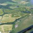
Aerial photographs show the remains of tidal-covered walling 70m long, [and] almost certainly a tidal fish-trap.
J Wordsworth 1992.
Tidal Fish Trap.
CFA/MORA Coastal Assessment Survey 1998.
Aerial Photographic Interpretation (1992)
Aerial photographs show the remains of tidal-covered walling 70m long, [and] almost certainly a tidal fish-trap.
J Wordsworth 1992.

