
Pricing Change
New pricing for orders of material from this site will come into place shortly. Charges for supply of digital images, digitisation on demand, prints and licensing will be altered.
Carpow


Square Barrow (Iron Age)(Possible)
Site Name Carpow
Classification Square Barrow (Iron Age)(Possible)
Canmore ID 77961
Site Number NO21NW 92
NGR NO 208 176
Datum OSGB36 - NGR
Permalink http://canmore.org.uk/site/77961


- Council Perth And Kinross
- Parish Abernethy (Perth And Kinross)
- Former Region Tayside
- Former District Perth And Kinross
- Former County Perthshire
NO21NW 92 208 176
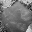
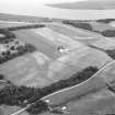
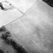
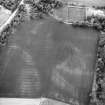
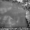
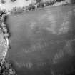
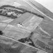
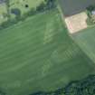
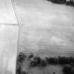
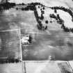
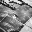
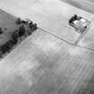
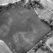
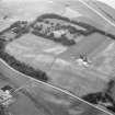
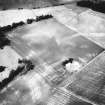
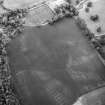
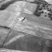
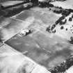
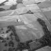
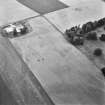
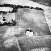
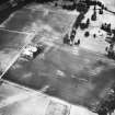
The cropmarks of what has tentatively been identified as a square barrow have been recorded by aerial photography (RCAHMSAP 1977, 1978, 1986 and 1991) 140m SW of Mains of Carpow steading (NO21NW 66.03) and about 40m S of the defences of the Roman legionary fortress NO21NW 24.00. The barrow measures about 10m across within its ditch.
Information from RCAHMS (JRS), 4 February 1997.

