
Following the launch of trove.scot in February 2025 we are now planning the retiral of some of our webservices. Canmore will be switched off on 24th June 2025. Information about the closure can be found on the HES website: Retiral of HES web services | Historic Environment Scotland
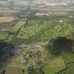
Glamis


Burgh (Medieval), Village (Period Unassigned)
Site Name Glamis
Classification Burgh (Medieval), Village (Period Unassigned)
Canmore ID 77463
Site Number NO34NE 52
NGR NO 38417 46543
Datum OSGB36 - NGR
Permalink http://canmore.org.uk/site/77463


- Council Angus
- Parish Glamis
- Former Region Tayside
- Former District Angus
- Former County Angus

