
Dunachtonmore


Clearance Cairn(S) (Period Unassigned), Farmstead(S) (Period Unassigned), Township (Period Unassigned)
Site Name Dunachtonmore
Classification Clearance Cairn(S) (Period Unassigned), Farmstead(S) (Period Unassigned), Township (Period Unassigned)
Canmore ID 77229
Site Number NH80SW 28
NGR NH 8100 0450
NGR Description Centred on NH 8100 0450
Datum OSGB36 - NGR
Permalink http://canmore.org.uk/site/77229


- Council Highland
- Parish Alvie
- Former Region Highland
- Former District Badenoch And Strathspey
- Former County Inverness-shire
NH80SW 28.00 centred on 8100 0450
NH80SW 28.01 NH 811 046 Township
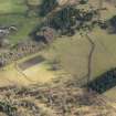
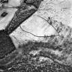
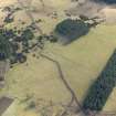
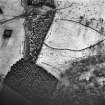
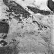
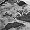
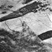
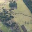
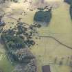
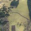
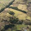
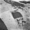
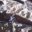
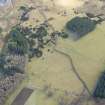
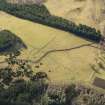
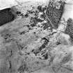
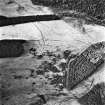
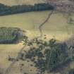
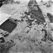
Air photographs have been taken of the deserted settlements W of Dunachtonmore farm. Three distinct settlements have been recorded and appear to be more extensive than as surveyed on the OS 1:10,000 map. A large area of clearance cairns as well as field dykes, partially buried, and apparently bowed-ended structures are visible. (See Archive for details.)
Information from J Harden 1990.
A township and two farmsteads are depicted on the 1st edition of the OS 6-inch map(Inverness-shire 1872, sheet lxxxvii).
Information from RCAHMS (SAH) 16 July 1996
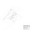
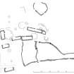
Measured Survey (4 June 2013)
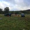
Dunachtonmore township was surveyed by RCAHMS and members of the local community in 2013 as part of the Cairngorms Community Heritage Project. The survey was undertaken using plane-table and self-reducing alidade to produce a site plan at a scale of 1:500.
Visited by RCAHMS (ECB, IP, AM) 4 June 2013

