
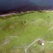
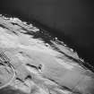
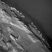
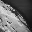
Lismore, Tirefour Castle


Farmstead (Post Medieval)
Site Name Lismore, Tirefour Castle
Classification Farmstead (Post Medieval)
Canmore ID 76781
Site Number NM84SE 26
NGR NM 8664 4292
Datum OSGB36 - NGR
Permalink http://canmore.org.uk/site/76781


- Council Argyll And Bute
- Parish Lismore And Appin (Argyll And Bute)
- Former Region Strathclyde
- Former District Argyll And Bute
- Former County Argyll
Note
A farmstead comprising three unroofed buildings, one unroofed circular structure, two enclosures and a field wall is depicted on the 1st edition of the OS 6-inch map (Argyllshire 1875, sheet lxxii). Three unroofed buildings and two enclosures, one of which is incomplete, are shown on the current edition of the OS 1:10000 map (1976).
Information from RCAHMS (SAH) 31 August 1998.

