Accessibility

Font Size

100% 150% 200%

Background Colour

Default Contrast
Close Reset

Methil, General

Burgh (Medieval), Town (Period Unassigned)

Site Name Methil, General

Classification Burgh (Medieval), Town (Period Unassigned)

Canmore ID 76023

Site Number NT39NE 12

NGR NT 3672 9913

NGR Description Centred NT 3672 9913

Datum OSGB36 - NGR

Permalink http://canmore.org.uk/site/76023

Ordnance Survey licence number AC0000807262. All rights reserved.
Canmore Disclaimer. © Bluesky International Limited 2025. Public Sector Viewing Terms

Toggle Aerial | View on large map

Digital Images

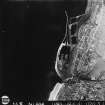
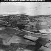
Oblique aerial view.
Oblique aerial view.RAF WWII vertical aerial photograph of Methil Town and Methil Docks and harbour.  The area covered extends from Leven to the NE edge of Buckhaven and inland as far as West Kirkland.RAF WWII oblique aerial photograph of Methil and Leven.  View west from Leven Links over Leven to Methil Docks.
No.1 CAM obliqueRAF WWII oblique aerial photograph of part of Methil Town from the NW. Taken from above a point just S of Kennoway.  Also visible is the harbour with part of a wartime convoy lying offshore.General oblique aerial view of the town of Methil and Methil Docks, looking N.

Administrative Areas

  • Council Fife
  • Parish Wemyss
  • Former Region Fife
  • Former District Kirkcaldy
  • Former County Fife

Archaeology Notes

NT39NE 12 centred 3672 9913

Said to have been erected burgh of barony (earl of Wemyss) by archbishop Sharp of St Andrews in 1662.

G S Pryde 1965.

Architecture Notes

NT39NE 12 3672 9913

The cottage depicted in collection item LOR F/13/1 cannot be identified at time of entry (AC 27 March 2002).

References

MyCanmore Image Contributions


Contribute an Image

MyCanmore Text Contributions