|
Photographs and Off-line Digital Images |
C 40287 CN |
RCAHMS Aerial Photography |
Edinburgh, oblique aerial view, taken from the S, showing Leith Docks in the top half of the photograph, and North Leith in the bottom half. |
1/9/1994 |
Item Level |
|
|
Photographs and Off-line Digital Images |
C 40289 CN |
RCAHMS Aerial Photography |
Edinburgh, oblique aerial view, taken from the SSE, centred on Leith Docks with North Leith in the bottom half. |
1/9/1994 |
Item Level |
|
|
Photographs and Off-line Digital Images |
C 40288 CN |
RCAHMS Aerial Photography |
Edinburgh, oblique aerial view, taken from the S, showing Leith and Leith Docks. |
1/9/1994 |
Item Level |
|
 |
On-line Digital Images |
SC 495685 |
|
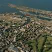
Edinburgh, oblique aerial view, taken from the S, showing Leith and Leith Docks. |
|
Item Level |
|
 |
On-line Digital Images |
SC 610442 |
RCAHMS Aerial Photography |
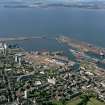
Scanned image of colour photograph, oblique aerial view, taken from the SSE, centred on Leith Docks with North Leith in the bottom half. |
1/9/1994 |
Item Level |
|
|
Photographs and Off-line Digital Images |
D 63421 |
Survey of a Private Collection: Photographs of Rosyth, Fife |
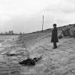
View looking east-northeast along the East Breakwater to Leith Docks and the Martello Tower.
The gentleman in the photograph has been identified as Mr John Dalgleish Easton, designer of the East Breakwater and former Civil Engineer for Leith Docks Commission, retired in March 1945. |
7/1/1945 |
Item Level |
|
 |
On-line Digital Images |
SC 1048637 |
|
View ENE to Martello Tower and docks.
The gentleman has been identified as Mr John Dalgleish Easton, Civil Engineer for the Leith Docks Commission and one of the desgners of the East Breakwater |
c. 7/1/1945 |
Item Level |
|
 |
On-line Digital Images |
SC 1677872 |
RCAHMS Aerial Photography |
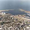
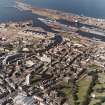
Edinburgh, oblique aerial view, taken from the S, showing Leith Docks in the top half of the photograph, and North Leith in the bottom half. |
1/9/1994 |
Item Level |
|
 |
On-line Digital Images |
SC 1677873 |
RCAHMS Aerial Photography |
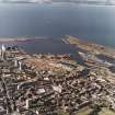
Edinburgh, oblique aerial view, taken from the S, showing Leith and Leith Docks. |
1/9/1994 |
Item Level |
|
 |
On-line Digital Images |
SC 1677874 |
RCAHMS Aerial Photography |
Edinburgh, oblique aerial view, taken from the SSE, centred on Leith Docks with North Leith in the bottom half. |
1/9/1994 |
Item Level |
|
|
Manuscripts |
MS 2221/01 |
Historic Scotland Archive Project |
Survey archive: Photographic register from Coastal Assessment Survey, 'The Firth of Forth from Dunbar to the Coast of Fife'. |
1996 |
Batch Level |
|
|
Photographs and Off-line Digital Images |
BP 55/06 CN |
Historic Scotland Archive Project |
Survey photographs: Leith Docks and associated buildings; Granton and Newhaven Harbours and nearby shops and houses; view of Cramond Island, harbour and foreshore with World War 2 defences; Muirhouse harbour and Portobello beach and pottery; Newhaven Chain Pier Bar; Seafield sewage works . |
1996 |
Batch Level |
|
|
Photographs and Off-line Digital Images |
BS 47/06 CS |
Historic Scotland Archive Project |
Survey photographs: Leith Docks and associated buildings; Granton and Newhaven Harbours and nearby shops and houses; view of Cramond Island, harbour and foreshore with World War 2 defences; Muirhouse harbour, Portobello pottery, Newhaven Chain Pier Bar and Seafield sewage works. Views of Oxroad Bay at Tantallon Castle and ditch at Auldhame.
(take out Portobellobeach 113101) |
1996 |
Batch Level |
|