
Following the launch of trove.scot in February 2025 we are now planning the retiral of some of our webservices. Canmore will be switched off on 24th June 2025. Information about the closure can be found on the HES website: Retiral of HES web services | Historic Environment Scotland
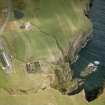
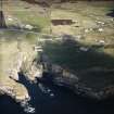
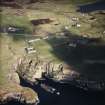
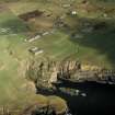
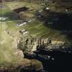
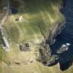
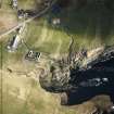
Bridgend


Farmstead (Period Unassigned)
Site Name Bridgend
Classification Farmstead (Period Unassigned)
Canmore ID 75454
Site Number ND34SW 266
NGR ND 3213 4059
Datum OSGB36 - NGR
Permalink http://canmore.org.uk/site/75454


- Council Highland
- Parish Wick
- Former Region Highland
- Former District Caithness
- Former County Caithness
ND34SW 266 3213 4059
Depicted on the 1st edition of the OS 6-inch map (Caithness), 1871.
(Undated) information in NMRS.
Bridgend farmstead is still inhabited and the buildings were not recorded on the date of visit.
Visited by RCAHMS (JRS) 15 June 2004.

