Accessibility

Font Size

100% 150% 200%

Background Colour

Default Contrast
Close Reset

Largs, General

Burgh (Medieval), Town (Period Unassigned)

Site Name Largs, General

Classification Burgh (Medieval), Town (Period Unassigned)

Canmore ID 75356

Site Number NS25NW 34

NGR NS 20360 59305

NGR Description Centred on NS 20360 59305

Datum OSGB36 - NGR

Permalink http://canmore.org.uk/site/75356

Ordnance Survey licence number AC0000807262. All rights reserved.
Canmore Disclaimer. © Bluesky International Limited 2025. Public Sector Viewing Terms

Toggle Aerial | View on large map

Digital Images

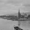
General oblique aerial view looking across the ore terminal towards Fairlie and Largs, taken from the S.
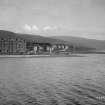
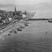
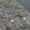
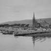
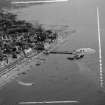
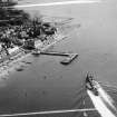
General oblique aerial view looking across the ore terminal towards Fairlie and Largs, taken from the S.General oblique aerial view of the town, taken from the SW.General oblique aerial view of the town, taken from the SW.General view of West end of Largs.Pier and Steamer Largs, Ayrshire, Scotland. Oblique aerial photograph taken facing North/East. This image was marked by AeroPictorial Ltd for photo editing.Looking to Isle of Arran Largs, Ayrshire, Scotland. Oblique aerial photograph taken facing West. General oblique aerial view of the town, taken from the WNW.General oblique aerial view of the town, taken from the W.General oblique aerial view looking across the electricity generating station towards the ore terminal, Fairlie and Largs, taken from the SSW.General view of seafront Largs, Ayrshire, Scotland. Oblique aerial photograph taken facing South. Largs.  Legal illustrations for Riddet versus Humphrey.
Site plans of road illustrating motor accident near Blackdales Garage.Unidentified.
Largs, houses.
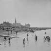
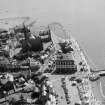
General view.Oblique aerial view.General oblique aerial view looking across the ore terminal towards Fairlie and Largs, taken from the SW.General oblique aerial view looking across the electricity generating station towards the ore terminal, Fairlie and Largs, taken from the SSW.View of Largs.General view of Largs from sea.General view of Largs from sea.General oblique aerial view of the town, taken from the SW.General View Largs, Ayrshire, Scotland. Oblique aerial photograph taken facing South. This image was marked by AeroPictorial Ltd for photo editing.General View Largs, Ayrshire, Scotland. Oblique aerial photograph taken facing South/East. This image was marked by AeroPictorial Ltd for photo editing.General oblique aerial view of the town, taken from the W.Sea, Largs burgh, Cunningham, StrathclydeView of Largs and bathersGeneral view of Largs from sea.General view Largs, Ayrshire, Scotland. Oblique aerial photograph taken facing North/East. This image was marked by AeroPictorial Ltd for photo editing.General view Largs, Ayrshire, Scotland. Oblique aerial photograph taken facing North/East. This image was marked by AeroPictorial Ltd for photo editing.General View Largs, Ayrshire, Scotland. Oblique aerial photograph taken facing South. General View Largs, Ayrshire, Scotland. Oblique aerial photograph taken facing East. This image was marked by AeroPictorial Ltd for photo editing.General oblique aerial view of the town, taken from the WSW.General oblique aerial view looking across the ore terminal towards Fairlie and Largs, taken from the S.

Administrative Areas

  • Council North Ayrshire
  • Parish Largs
  • Former Region Strathclyde
  • Former District Cunninghame
  • Former County Ayrshire

Archaeology Notes

NS25NW 34 20360 59305

Licensed as burgh of barony in 1629; de novo erected burgh of barony in 1631.

G S Pryde 1965.

Architecture Notes

NMRS REFERENCE:

1906 Proposed extension of Burgh Boundaries.

Architect unknown.

Plans at Darley Hay Partnership, Ayr.

Activities

Aerial Photography (1935 - 1938)

An collection of aerial photographs taken by Andrew P Hunter from 1935 to 1938. Digitised by Andrew B Wilson in 2008.

References

MyCanmore Image Contributions


Contribute an Image

MyCanmore Text Contributions