
Following the launch of trove.scot in February 2025 we are now planning the retiral of some of our webservices. Canmore will be switched off on 24th June 2025. Information about the closure can be found on the HES website: Retiral of HES web services | Historic Environment Scotland
Maybole, General


Burgh (Medieval), Town (Medieval) - (Post Medieval)
Site Name Maybole, General
Classification Burgh (Medieval), Town (Medieval) - (Post Medieval)
Canmore ID 75349
Site Number NS20NE 24
NGR NS 2986 0999
NGR Description Centred NS 2986 0999
Datum OSGB36 - NGR
Permalink http://canmore.org.uk/site/75349


- Council South Ayrshire
- Parish Maybole
- Former Region Strathclyde
- Former District Kyle And Carrick
- Former County Ayrshire
NMRS REFERENCE:
Carnegie Free Library
Architect: James Kennedy Hunter
Carrick Provident (Co-op).
Architect:
J. Murdoch. nd. Sketch Plans.
Plans: at Darley Hay Partnership, Ayr.
EXTERNAL REFERENCE
Architect: Maybole - maps of the Turnpike and Parish Roads.
Plans: at Darley Hay Partnership, Ayr.
(Undated) information in NMRS.
Field Visit (September 1982)
Maybole NS 300 099 NS30NW 1, 6 & 7 NS31SW 12
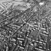
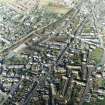
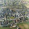
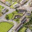
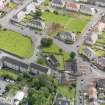
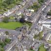
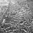
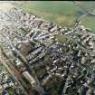
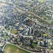
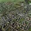
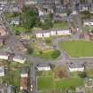
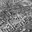
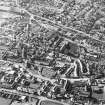
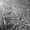
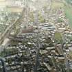
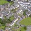
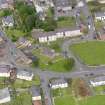
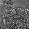
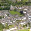
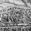
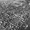
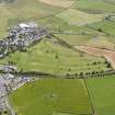
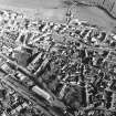
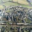
Maybole was erected a burgh of barony in 1516 and contained the town houses of many of the local gentry. The castle was probably built by the Earl of Cassi II is in the early 17th century, and the tolbooth, the tower of which is incorporated in the town hall, was formerly a house of the Laird of Blairquhan. There are no visible remains of the medieval parish church of Maybole, which stood in the burial-ground immediately NE of the scheduled collegiate church.
RCAHMS 1983, visited September 1982
(MacGibbon and Ross 1887-1902, iii, 498-502; v, 115-16; MacGibbon and Ross 1896-7, iii, 338-43; Macfarlane 1906-8, ii, 16-18; Pryde 1965, 57, no. 205; Cowan 1967, 144-5; Gray 1972).
Photographic Survey (January 2003)
During the winter of 2002/03, a photographic survey was carried out jointly by Kirkdale Archaeology and the Centre for Scottish Urban History at the University of Edinburgh. This work was part of the research phase of work done for the Scottish Burgh Survey publication, 'Historic Maybole' (2005).
Sponsor: Historic Scotland

