Pricing Change
New pricing for orders of material from this site will come into place shortly. Charges for supply of digital images, digitisation on demand, prints and licensing will be altered.
Upcoming Maintenance
Please be advised that this website will undergo scheduled maintenance on the following dates:
Thursday, 9 January: 11:00 AM - 3:00 PM
Thursday, 23 January: 11:00 AM - 3:00 PM
Thursday, 30 January: 11:00 AM - 3:00 PM
During these times, some functionality such as image purchasing may be temporarily unavailable. We apologise for any inconvenience this may cause.
Bellie
Pit Alignment (Prehistoric)
Site Name Bellie
Classification Pit Alignment (Prehistoric)
Canmore ID 75222
Site Number NJ36SW 32
NGR NJ 347 602
NGR Description NJ 347 603 to NJ 346 599
Datum OSGB36 - NGR
Permalink http://canmore.org.uk/site/75222
- Council Moray
- Parish Bellie
- Former Region Grampian
- Former District Moray
- Former County Morayshire
NJ36SW 32 347 602 to 346 599
See also NJ36SW 19.
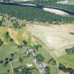
While checking vertical aerial photographs held by Grampian Regional Council, a pit alignment was noted running N-S from NJ 347 603 to NJ 346 599 along edge of field bordering river. In same fields as two previously reported pit alignments (NJ36SW 19).
Sponsors: Historic Scotland, Grampian Regional Council.
R Feilden 1991i.
(Location cited as NJ 348 601). Air photography (CUCAP AGK 85, flown 23 July 1962; CUCAP BKG 90, flown 28 July 1972: AAS/88/01/S3/1-14, flown 24 June 1988) has recorded the cropmarks of a pit-alignment on river haughland at an altitude of about 5m OD. It runs E-W for a distance of about 250m, and CUCAP AGK 85 shows a short angles spur at the W end.
NMRS, MS/712/36.


