
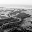
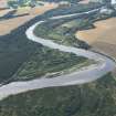
River Spey, 'cumberland's Ford'


Ford (Period Unassigned)
Site Name River Spey, 'cumberland's Ford'
Classification Ford (Period Unassigned)
Canmore ID 75203
Site Number NJ36SW 28
NGR NJ 342 608
Datum OSGB36 - NGR
Permalink http://canmore.org.uk/site/75203


- Council Moray
- Parish Speymouth
- Former Region Grampian
- Former District Moray
- Former County Morayshire
NJ36SW 28 342 608
Cumberland's Ford (NAT) (site of)
OS 6-inch map, 1971.
Where Cumberland's army crossed the Spey before Culloden.
OS Name Book.

