|
Photographs and Off-line Digital Images |
SU 1114 |
List C Survey |
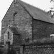
General view |
1975 |
Item Level |
|
|
Photographs and Off-line Digital Images |
DP 128733 |
Buildings at Risk Register |
East elevation |
1/11/1997 |
Item Level |
|
|
Photographs and Off-line Digital Images |
DP 128734 |
Buildings at Risk Register |
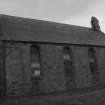
South elevation |
1/7/1998 |
Item Level |
|
|
Photographs and Off-line Digital Images |
DP 128735 |
Buildings at Risk Register |
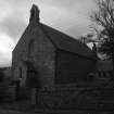
South and east elevation |
1/11/1997 |
Item Level |
|
|
Photographs and Off-line Digital Images |
DP 139538 |
Buildings at Risk Register |
Chapel of Ease - East/ North Elevations |
19/6/2012 |
Item Level |
|
|
Photographs and Off-line Digital Images |
DP 139539 |
Buildings at Risk Register |
Chapel of Ease - South Elevation |
19/6/2012 |
Item Level |
|
|
Photographs and Off-line Digital Images |
DP 192228 |
Buildings at Risk Register |
Front/ side elevations |
2/10/2013 |
Item Level |
|
 |
On-line Digital Images |
SC 1644017 |
List C Survey |
General view |
1975 |
Item Level |
|
|
Photographs and Off-line Digital Images |
DP 280606 |
Historic Environment Scotland |
View of Front Elevation |
18/9/2018 |
Item Level |
|
 |
On-line Digital Images |
SC 2001867 |
Scottish Development Department |
Former Church of Scotland, Stafford Street, Helmsdale, Kildonan parish, Sutherland, Highlands |
28/9/1981 |
Item Level |
|
 |
On-line Digital Images |
SC 2001868 |
Scottish Development Department |
Former Church of Scotland, Stafford Street, Helmsdale, Kildonan parish, Sutherland, Highlands |
28/9/1981 |
Item Level |
|
 |
On-line Digital Images |
SC 2351343 |
Records of the Ordnance Survey, Southampton, Hampshire, England |
Helmsdale, Stafford Street, St John's Church, ND01NW 54, Ordnance Survey index card, Recto |
c. 1958 |
Item Level |
|