Jordan Sike
Archaeological Landscape (Medieval) - (Post Medieval)
Site Name Jordan Sike
Classification Archaeological Landscape (Medieval) - (Post Medieval)
Alternative Name(s) Steel Knowe
Canmore ID 74644
Site Number NT60NE 38
NGR NT 6535 0875
NGR Description Centred NT 6535 0875
Datum OSGB36 - NGR
Permalink http://canmore.org.uk/site/74644
- Council Scottish Borders, The
- Parish Southdean
- Former Region Borders
- Former District Roxburgh
- Former County Roxburghshire
Field Visit (22 April 1992)
NT60NE 38 centred 6535 0875
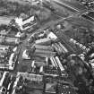
This archaeological landscape occupies the terraces along the E side of the Jordan Sike from Northbank Cottage in the N to the public road from Carter Bar to Hawick in the S, a distance of 1.25km. It comprises round-ended buildings, turf huts, rig, stock enclosures and grouse butts, most of which are enclosed within the successive phases of boundary banks.
NT60NE 38.01 Centred NT 6535 0880 Boundary Banks; Rig; Stock Enclosures; Shooting Butts
NT60NE 38.02 NT 6543 0893 Buildings: Round-ended (ROX92 8,9,77) [Steel Knowe]
NT60NE 38.03 NT 6531 0856 Huts (ROX92 6,7) [Steel Knowe]
Visited by RCAHMS (PJD), 22 April 1992.
Sbc Note
Visibility: This is an upstanding earthwork or monument.
Information from Scottish Borders Council


