Pricing Change
New pricing for orders of material from this site will come into place shortly. Charges for supply of digital images, digitisation on demand, prints and licensing will be altered.
Northbank Tower
Building(S) (Medieval), Pele House (16th Century), Stock Enclosure (Post Medieval)
Site Name Northbank Tower
Classification Building(S) (Medieval), Pele House (16th Century), Stock Enclosure (Post Medieval)
Canmore ID 74610
Site Number NT60NE 9.01
NGR NT 66091 09427
Datum OSGB36 - NGR
Permalink http://canmore.org.uk/site/74610
- Council Scottish Borders, The
- Parish Southdean
- Former Region Borders
- Former District Roxburgh
- Former County Roxburghshire
NT60NE 9.01 66091 09427.
(NT 6609 0942) Northbank Tower (NR) (remains of)
OS 6" map, (1963)
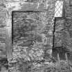
Fragmentary remains of a 16th century pele-house stand about 500 yds E of Northbank. The building is oblong, 27'3" NE-SW by 22'6" over walls varying from 4'3" to 4'9" in thickness and now rising to a greatest height of 7'
The masonry is rubble in large boulders, and the material no doubt came from the old quarry close by on the W. The original name of this place was probably "The Banks".
RCAHMS 1956, visited 1932.
This pele-house is as described. Modern sheep-shelters extend from the NE, SW and SE angles; adjacent on the NW is a turf-banked enclosure about 23.0m square, which may be contemporary with the tower.
Visited by OS(JLD) 11 October 1960
No change to previous information.
Visited by OS(TRG) 21 September 1976
Field Visit (25 February 1992)
The pele-house called Northbank Tower, which has been reduced to a single storey and converted for use as a sheepfold, stands on a terrace on the S side of the Shaw Burn. It measures 5.3m from NE to SW by 4m transversely within rubble-faced earth-bonded walls which range from 1.3m to 1.5m in thickness and up to 2.3m in height; it is entered from the NE, but the SE side of the entrance has been very much reduced and rebuilt in drystone rubble. There is a scarcement 1.8m above ground level on the SE side. On the same terrace as the pele-house there is a rectilinear stock enclosure, which overlies the faint traces of what may have been the platforms of buildings and a small enclosure on the NE side of the tower.
On the lip of the whinstone terrace 30m SW of the tower are two turf-walled buildings, one of which has been cut away at its N end by quarrying. The W building measures 8.8m from NE to SW by 3.3m transversely within turf walls spread to 2.2m in thickness and 0.3m in height. The E building measures 12m from NE to SW by 7.6m transversely over turf walls reduced to 0.25m in height. The best parallels for these structures are the turf-walled buildings at Shiel Rig (NT60NE 24). A settlement called Northbank is depicted on Blaeu's map of Teviotdale, based upon Pont (Blaeu 1654), but not on Roy's map (Roy 1747-55) or Stobie's map of Roxburghshire (Stobie 1770). In the Hearth Tax return for 1691 there are two persons each with one hearth at Northbank (SRO E69/21/1).
Visited by RCAHMS (PJD) 25 February 1992.
Note (3 November 2015)
This monument was delisted and was removed from the list of buildings of special architectural or historic interest.
The structure is still designated as a scheduled monument under the Ancient Monuments and Archaeological Areas Act 1979.
Information from Historic Environment Scotland, 3rd November 2015
Sbc Note (21 March 2016)
Visibility: This was the site of an archaeological monument, which may no longer be visible.
Information from Scottish Borders Council
Previously also listed under duplicate site NT96SW 510 -CANCELLED. HES (LCK) 11.6.2024


