
Following the launch of trove.scot in February 2025 we are now planning the retiral of some of our webservices. Canmore will be switched off on 24th June 2025. Information about the closure can be found on the HES website: Retiral of HES web services | Historic Environment Scotland
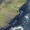
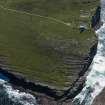
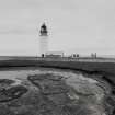
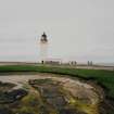
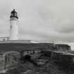
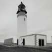
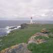
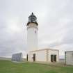
Westray, Noup Head Lighthouse


Lighthouse (19th Century)
Site Name Westray, Noup Head Lighthouse
Classification Lighthouse (19th Century)
Canmore ID 74474
Site Number HY34NE 3
NGR HY 39200 49902
Datum OSGB36 - NGR
Permalink http://canmore.org.uk/site/74474


- Council Orkney Islands
- Parish Westray
- Former Region Orkney Islands Area
- Former District Orkney
- Former County Orkney
HY34NE 3.00 39200 49902
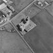
HY34NE 3.01 39235 49899 Perimeter Wall and Gate-piers
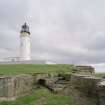
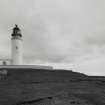
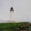
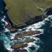
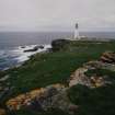
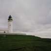
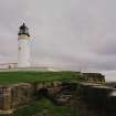
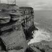
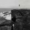
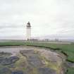
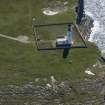
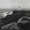
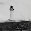
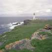
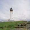
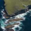
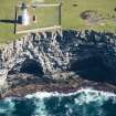
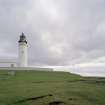
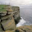
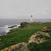
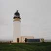
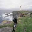
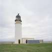
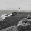
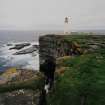
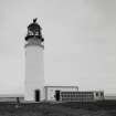
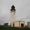
(Location cited as HY 392 499). Noup Head lighthouse, Westray, completed 1898 by engineer D Alan Stevenson. A short tapering circular section tower with walkways at two levels. There are single-storey, flat-roofed keepers' houses, with prominent quoins. Unmanned since 1964.
J R Hume 1977.
The semi-detached single-storey keepers' houses mentioned by J R Hume are depicted on the 2nd edition OS 6-inch Map (Fife and Kinross, 1901, sheet LXXIV), but have since been demolished.
Information from RCAHMS (ITMP), January 2008
Field Visit (1998)
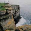
Designed by David Stevenson and built in 1898, the Noup Head lighthouse provides warning of the North Shoal. The light has been automated and the keepers cottages are sealed up. The surrounding area is a designated RSPB sanctuary with one of the largest colonies of kittiwakes and guillemots in Britain.
Moore and Wilson, 1998
Coastal Zone Assessment Survey

