Pricing Change
New pricing for orders of material from this site will come into place shortly. Charges for supply of digital images, digitisation on demand, prints and licensing will be altered.
Upcoming Maintenance
Please be advised that this website will undergo scheduled maintenance on the following dates:
Thursday, 9 January: 11:00 AM - 3:00 PM
Thursday, 23 January: 11:00 AM - 3:00 PM
Thursday, 30 January: 11:00 AM - 3:00 PM
During these times, some functionality such as image purchasing may be temporarily unavailable. We apologise for any inconvenience this may cause.
Marchmont House, Walled Garden With Glasshouses And Sunken Garden
Walled Garden (Period Unassigned)
Site Name Marchmont House, Walled Garden With Glasshouses And Sunken Garden
Classification Walled Garden (Period Unassigned)
Canmore ID 74350
Site Number NT74NW 20.03
NGR NT 74463 48428
Datum OSGB36 - NGR
Permalink http://canmore.org.uk/site/74350
- Council Scottish Borders, The
- Parish Polwarth
- Former Region Borders
- Former District Berwickshire
- Former County Berwickshire
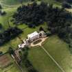
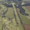
To the south-east of Marchmont House, there is a large walled garden with associated glasshouses and potting sheds. The gardens and buildings probably date from the nineteenth century, and several original features survive.
The 1st edition of the Ordnance Survey 6-inch map, dating from the late nineteenth century, illustrates the layout of the garden, then divided into eight square sections. Little of that design survives, other than the box-hedges which still line the central path. The enclosing walls of the large, rectangular garden are built of rubble, partially lined with red brick. A smaller, irregularly shaped garden lies immediately to the west.
Outside the garden, there is a large glasshouse, also dating from the nineteenth century. It contains original work-benches and decorative iron floor grilles above the heated pipes. Potting sheds, built of rubble and red brick, are built against the garden walls.
Above the north-east doorway into the garden, there is a panel bearing the date 1712. This is said to have come from the old courthouse of Greenlaw, which was demolished in 1830.
Text prepared by RCAHMS as part of the Accessing Scotland's Past project
NT74NW 20.03 74463 48428
Visible on Ordnance Survey large scale vertical air photographs (OS 70/365/153-5).
Watching Brief (28 January 2013 - 7 March 2013)
AOC Archaeology group was commissioned by Richard Amos Ltd on
behalf of their clients to undertake a watching brief at Marchmont
House, Greenlaw, the Scottish Borders. The watching brief was to
monitor works associated with the installation of a biomass boiler and
accumulator tank at Marchmont House.
Several features relating to post-medieval activity were recorded during
the excavations including five midden and waster pits, as well as former
services and foundations relating to ranges associated with Redbraes
Castle. The upstranding gable end of the southwestern range of the
castle was identified incorporated into a former estate cottage which is
itself now ruined.
Jake Streatfeild-James (AOC Archaeology Group) 7 March 2013: OASIS--ID: aocarcha1-145727
Sbc Note
Visibility: This is an upstanding earthwork or monument.
Information from Scottish Borders Council


