
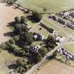
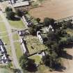
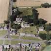
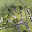
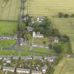
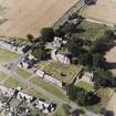
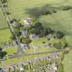
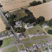
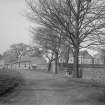
Dalmeny Village, General


Burgh (Medieval), Village (Period Unassigned)
Site Name Dalmeny Village, General
Classification Burgh (Medieval), Village (Period Unassigned)
Alternative Name(s) Edinburgh
Canmore ID 73633
Site Number NT17NW 176
NGR NT 144 774
NGR Description Centred NT 144 774
Datum OSGB36 - NGR
Permalink http://canmore.org.uk/site/73633


- Council Edinburgh, City Of
- Parish Dalmeny
- Former Region Lothian
- Former District City Of Edinburgh
- Former County West Lothian
NT17NW 176 centred 144 774
Licensed as burgh of barony in 1616.
G S Pryde 1965.
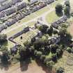
NT 143 774 An area ground resistance survey of the broad grass verges at the road junction in the village commenced in the NW corner to ascertain whether the medieval village was built closer to the road. The results show slight parallel lines that may represent property boundaries, but no foundations were detected. Further W, adjacent to Wester Dalmeny, a number of irregular high resistances may link to previous findings (DES 2002, 53). The only other recognisable feature is a footpath shown on the 1896 25" OS map.
Sponsors: HS, Edinburgh Archaeological Field Society.
H M D Jones 2004.

